Everett-Mukilteo-Whidbey Island Century


Ev-Muk-Whid road

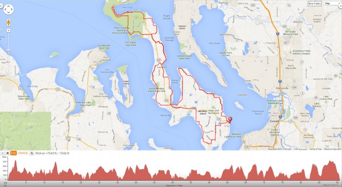
We’re now a bit further north of Seattle in the city of Everett for a century ride that begins from Lakeside RV Park to Mukilteo and continues with a ferry ride out to Whidbey Island for a 91 mile hilly route that roughly goes in a counter clock-wise NW figure eight direction through the towns of Clinton, Langley, Freeland, Greenbank and Coupeville.

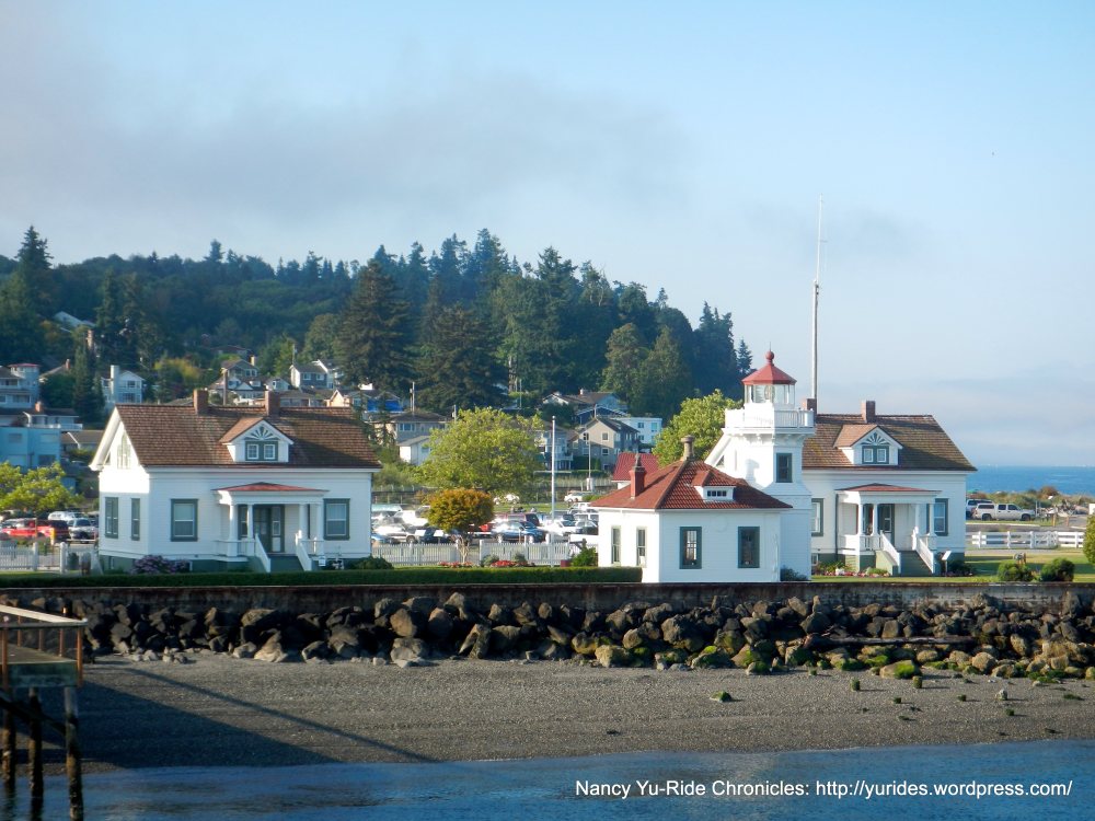
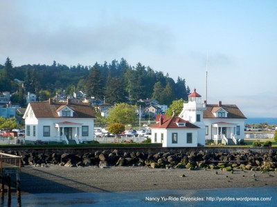
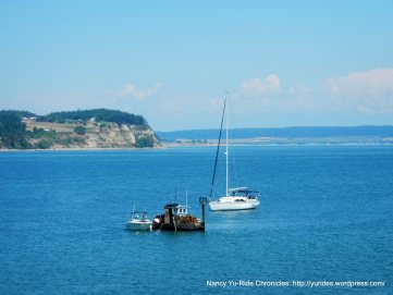
We exit the RV Park and take WA-99 to WA-525/Mukilteo Speedway for the eight miles down to the Mukilteo Ferry Terminal. The fare to Whidbey Island is $4.65 (other discounts may apply if eligible) plus a $1 bicycle surcharge. Arrive 15-20 minutes before departure time to be loaded prior to the vehicle loading process. There are no bike racks; they can be hooked on or strapped to the yellow side railings of the boat. The ferry crossing to Clinton is an enjoyable 20 minutes from Mukilteo.

muk-lighthouse

From the Clinton Ferry Dock, we take WA-525 to Bob Galbreath Rd; this road initially goes through the residential neighborhoods of Clinton before winding out towards the dense wooded area on Wilkinson Rd. The rolling hills takes us pass the Comforts Farm and Vineyards and a cute little farm stand at Ryrose Ranch.

Sandy Point Rd leads us onto the Langley Loop on Camano Ave; this road takes us into the seaside town of Langley pass the cool graphics at the Whidbey Island Center for the Arts. I also noticed lots of grazing bunnies roaming freely around the surrounding grassy areas and at the campground cross the street.

The Langley Loop continues on Cascade Ave; this short stretch of road runs along the top of the bluff with amazing views of Puget Sound. This tiny town of less than 3/4 of a mile square is filled with historic buildings that house the many different galleries, studios, boutiques, B&B’s, Inns, cafes and restaurants. Even in this small community of 950 people, there are three different churches and a Alcoholics Anonymous!

Saratoga Rd leads us out of town to the “country’ with its open pastoral meadows, ranches and farms. The road heads north up to the tip at Baby Island Heights along the hidden backyards of the waterfront community.

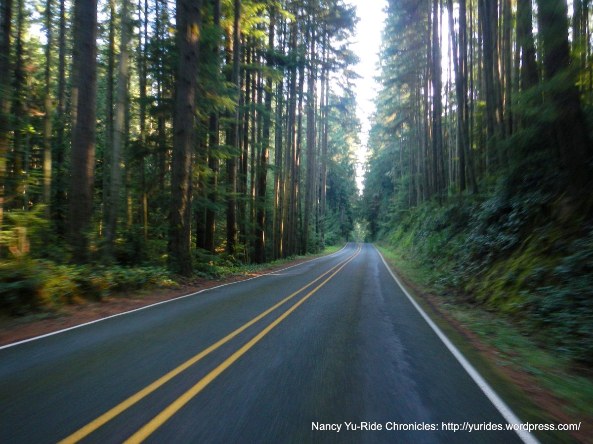
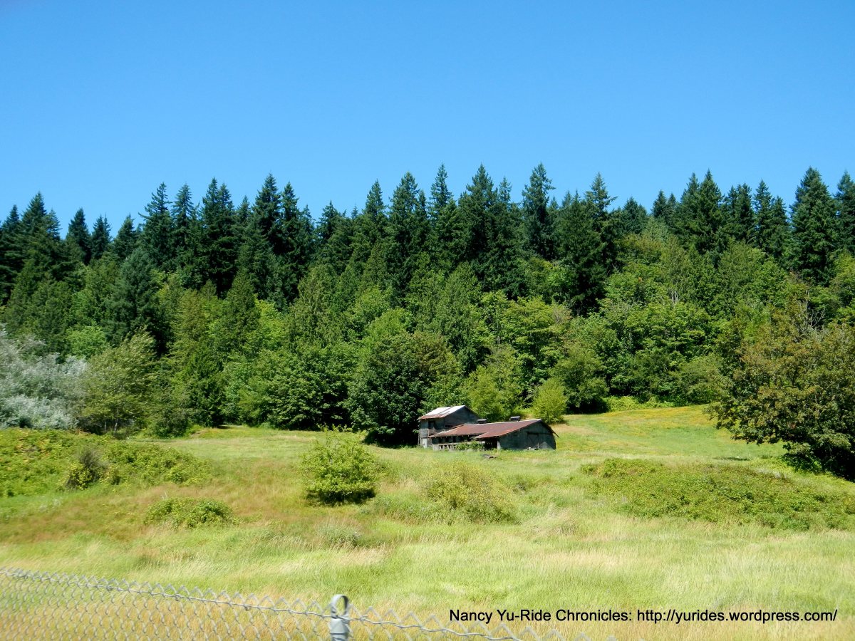
We head south on East Harbor Rd; this quiet road goes through a huge section of dense forest with small residential neighborhoods hidden behind the woods. You see the occasional flower stand out on the side of the road along with grazing deer.

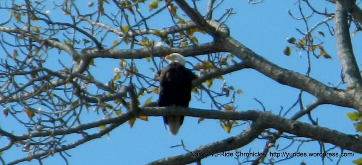
East Harbor Rd ends at the outskirts of another small community-Freeland. Freeland is the island’s retail and financial center. We continue on S Stewart Rd to Freeland Park for a quick pit stop. This park has a boat launch area with gorgeous views of Holmes Harbor! I even spot a bald eagle perched up on a tree-WOW!

whid-eagle

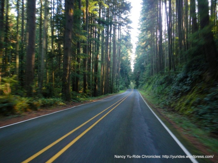
The short steep climb up Shoreview Dr takes us across WA-525 to E Bush Point Rd; this road goes through the rural farmlands out towards the small residential areas around Mutiny Bay. Smugglers Cove Rd is a road that runs parallel to Bush Point and continues north through the lush forests to South Whidbey State Park. This is a great shaded place to stop for a quick snack, water & restrooms. The rolling climbs on Smugglers Cove Rd continue pass Lagoon Point and weaves its way out to WA-525.

From WA-525, we make a quick turn onto North Bluff Rd into the smallest town on the island-Greenbank. This town is situated on the narrowest point of the island and is home to the historic Greenbank Farm-a popular tourist destination. You simply can’t miss the bright red barn-it stands out against the green agricultural fields!

We stay on North Bluff Rd for next rolling 3.8 miles to the steep climb up Houston Rd and get back on WA-525 N to Race Rd. Race Rd runs along the east edge of the island near Harrington Lagoon. Morris Rd turns west and opens up to the expansive meadows of Smith Prairie.

Parker Rd leads us into the town of Coupeville, on Penn Cove along the eastern shore of the island. Our lunch stop is at the Knead & Feed Bakery Restaurant on Front St. There’s a little sitting area next to the bakery with fabulous views of Penn Cove.

Coupeville is like a blast from the past with its beautiful Victorian homes and original blockhouses. The historic Front St has the usual mixes of antique shops, boutiques and restaurants. The Coupeville Wharf is one of the only remaining original wharfs and wharf building in the Pacific Northwest-WOW! This is another popular tourist destination spot!

We exit Coupeville and head a bit further west along Madrona Way; this beautiful madrona tree lined road hugs the shoreline of Penn Cove to Kennedys Lagoon. The 3.7 miles on WA-20 takes us back into Coupeville.

coup-bay

From Coupeville, we turn onto S Engle Rd for the flat stretch through Ebbys Prairie; this rural area is a rich coastal farmland with fields and fields of barley, oats and organic grains. With views of Puget Sound in the far distance, the road drops down into Fort Casey State Park, north of the Coupeville Ferry Terminal.

We continue on Fort Casey Rd up to the Crockett Blockhouse and Crockett Farm with views of Crockett Lake.

W Wanamaker Rd cuts through the coastal farmlands and ranches near Crockett Lake out to WA-505.

This section of the route retraces itself on WA-525 to Houston Rd and North Bluff Rd back to Greenbank. We continue on WA-525 S to the rolling hills on Resort Rd and Honeymoon Bay Rd towards Holmes Harbor. We get back on WA-525 through the towns of Freeland and Bayview.

The turn on Bayview Rd takes us through the small neighborhoods towards the southern point of the island near Cultus Bay. We weave our way along the shoreline on Ewing Rd, Sills Rd to Maxwelton with views of Useless Bay.

The steady climb up Swede Hill Rd takes us to the descent on Scatchet head Rd to Bailey Rd. We continue north on the rolling climbs up Cultus Bay Rd to Deer Lake Rd. The last few rollers on Deer Lake Rd take us back onto WA-525 into Clinton and to the Clinton Ferry Terminal.

It’s a relaxing scenic 20 minute ferry ride back to Mukilteo. The steady climb up Mukilteo Speedway/WA-525 takes us to WA-99 and back to the RV Park in Everett.

Whidbey Island is the largest island in Puget Sound and only 29 miles away from Seattle. It’s still very close but seems a far distance away in terms of old world feel-it’s a wonderful getaway! It’s a beautiful rural island with many small communities dotted and hidden amongst the verdant forests with plenty of history and charm! Here’s another tidbit I learned from talking to a local, there are no mosquitoes and because the island is situated in the rain shadow of the Olympics, they have more sunshine than any other Western Washington location! It might be time to move! So go ahead, go north and enjoy the quiet hilly country roads and gorgeous coastal rural landscapes that comes along with it! There are no bad roads, they’re all well maintained with minimal to no traffic except for the busy sections along WA-525 and WA-20, even then, there’s plenty of shoulder area to ride on.

Garmin Stats:
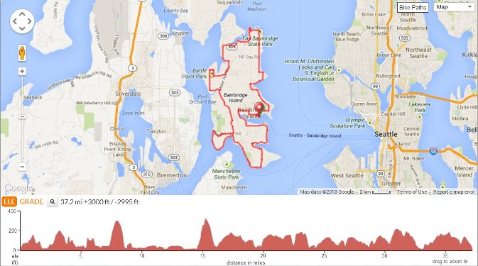
107.23 Miles with 7776′ of elevation gain
(includes 16 out & back miles from Everett to Mukilteo)
Max elevation: 398′
Max grade: 14%
Terrain: Hilly

Weather: FANTASTIC! Sunny, warm and clear with temps ranging from the low 50’s to the low 80’s. NNE winds with 94% humidity

ev-whid-coup

Guest blogger Nancy Yu writes about her bike travels at Ride Chronicles. She says, “I loved cycling around Washington. It’s a beautiful state with a wonderful network of trails and bike-friendly people. I ride to explore and love sharing my findings! I hope the write-ups and pictures will inspire those who can to get out there and enjoy the natural beauty of all that is available to us.”

Posted in Adventure, Bike Blogs, Guest Blogger, Rides, Whidbey Island | Tagged , , , , , , , , , , , , | Comments Off on Everett-Mukilteo-Whidbey Island Century

2016 Washington Bikes Legislative Agenda

Washington Bikes’ 2016 Legislative Agenda seeks to protect historic investments in biking, support distracted driving legislation, grow bicycle travel and tourism, and protect trails.

Trying to outdo what was arguably the most successful legislative sessions for biking in Washington state history is a tall order. In 2015, Washington Bike’ priority legislation, the “dead red” bill, passed in its first attempt with strong bipartisan support for a common-sense safety solution. The Washington State Legislature also passed a state transportation package, which invests approximately $500 million for biking, walking, Safe Routes to Schools, and complete streets projects over the next 16 years. Additionally, the two-year state capital budget invested in a record $15.5 million to build important trail connections statewide. To top it off, the legislature passed a bill to establish an outdoor recreation sector lead in the Governor’s Office and to support important changes for outdoor youth education.Little girl on bike seen from te back, wearing helmet, others biking/walking in street.

All those achievements didn’t come easy as the legislature went through not one, but three special overtime sessions. It amounted to a record 176 days in session (the 2015 legislature originally was scheduled to last 105 days). By most accounts, many remain fatigued and are looking to complete the “short” 60-day second session of the two-year biennium on time.

The 2016 Legislative Agenda

Washington Bikes Board of Directors and its Legislative and Statewide Issues Committee set a 2016 approach with four focus areas that largely mirrors last year’s agenda. It adds one significant focus to protect trails, like the John Wayne Pioneer Trail.

Here are the four priority areas (note, they are not prioritized by the Committee or the Board):

Investments that get Washingtonians where they want to go

Washington Bikes continues to support transportation investments that focus on smart investments in successful programs that provide safe and healthy routes to schools for our children, complete streets for Washington’s main streets and business districts, as well as investments in trails and bikeways that improve mobility and spur economic development in rural and urban areas alike.

  • Ask: (1) Retain historic funding levels made by 2015 Legislature for the Safe Routes to School Grant Program, Bicycle Pedestrian Safety Grant Program, Complete Streets Grant Program, as well as the bicycle and pedestrian project list.

Protecting Trails Statewide

Washington state has some of the longest and most iconic trails in the nation for biking, walking. Washington Bikes is committed to keeping trails open and accessible. Washington Bikes will monitor and explore the potential for additional investments that connect and improve trails for neighboring residents, visitors, and neighboring communities that benefit from the economic opportunities that trails bring via the $3.1 billion that bicycle riders spend in Washington state.

Growing the Multimillion Dollar Bicycle Travel & Tourism Industry

Bicycle travel and tourism is big business. According to a 2015 Economic Impact study from the Governor’s Task Force on Parks and Outdoor Recreation, Washington state bicycle riders spend $3.1 billion annually. An improved understanding of bike travel and tourism in Washington state is needed to make smart choices for growth statewide, particularly in rural areas.

  • Ask: Funding for a study of the economic impact of bicycle travel and tourism by the Department of Commerce will help quantify the industry and improve strategies to grow our state’s economy.

Strengthen Washington State’s Distracted Driving Laws

Following Washington Bikes successful lobbying in 2010, this Washington Traffic Safety Commission (WTSC) agency request legislation improves upon the current law by broadening the definition so that any person (with much narrower exceptions) operating a motor vehicle while holding a personal wireless communications device is guilty of a traffic infraction. It closes loopholes such as being able to use one’s phone while stopped at an intersection or stoplight (currently legal), it also expands the definitions of handheld uses to ban texting and email use on smart phones. Additional violations receive twice the penalty, plus violations go on one’s driver record for insurance purposes. Finally, distracted driving would be included in Department of Licensing exams (currently they are not).

  • Ask: WTSC agency request legislation.


Posted in Advocacy, Economic Impact, Funding/Policy, Infrastructure, Issues & Advocacy, Legislature, News, Safe Routes to School, Trails, Transportation | Comments Off on 2016 Washington Bikes Legislative Agenda

Bainbridge Island Bike Ride

bainbridge yu ride

We’re getting on the ferry again for a bike ride around Bainbridge Island. The fare  to Bainbridge Island is $7.70 (other discounts may apply if eligible) plus a $1.00 bicycle surcharge. Arrive 15-20 minutes before departure time to be loaded prior to the vehicle loading process. There are no bike racks; they can be hooked on or strapped to the yellow side railings of the boat. The ferry crossing is a scenic 35 minute cruise from Seattle’s waterfront.

Downtown Bainbridge Island looks like it was recently revamped with new sidewalks and hanging baskets of colorful flowers. The area is very walkable being only a block away from the ferry terminal on Winslow Way E. You can window shop through the galleries and boutiques and when you need a break, stop at one of the many cafes, restaurants and bakeries for a bite to eat. It’s also a progressive community with a new urban One Planet neighborhood; Grow Community. It’s an attractive way of living while using fewer of earth’s resources; zero carbon and waste, sustainable transport and local and sustainable food and water-very impressive and stylish too!

We exit the downtown area to Eagle Harbor Dr NE, this road runs along the shoreline of Eagle Harbor and through the wooded neighborhoods out to Rockaway Beach Rd NE. The road becomes NE Halls Hill Rd as it steeply curves around Blakely Harbor to Blakely Hill Rd and Blakely Ave.

The turn on NE Country Club Rd takes us pass the large estate homes nestled in the woods with fabulous waterfront views. We continue south on Toe Jam Hill NE for the 0.7 mile 7-10% climb followed by a fast drop down to NE South Beach Rd.

bb-art-museum

NE South Beach Rd hugs the shoreline with huge waterfront homes overlooking Puget Sound-the views are spectacular!  This is where we spot a young bald eagle perched out on the old wooden pier. We spoke with a resident and were told that the eagle is a “regular” on this side of the island, he’s out on the pier every morning-WOW!

NE South Beach Rd continues behind the waterfront homes and comes to an end at the neighborhood traffic circle. The non-vehicular path at the opposite end leads straight into the forest and through Fort Ward Park.

The north end of the path opens onto Pleasant Beach Dr NE with large waterfront estate homes hidden amongst the deep green forests. The road continues into the neighborhood center at Lynwood; this small Tudor-style shopping center has a theatre, a few shops and a market.

We exit Lynwood on Point White Dr NE to the SW tip of the island through the Crystal Springs neighborhood around Point White Dock. It’s a cute area of shoreline with beached wooden boats, fantastic waterfront views, rocky beaches and many Adirondack style chairs just waiting to be used to enjoy the most likely gorgeous sunsets!

The climbs on NE Baker Hill Rd lead inland back towards Lynwood to Lynwwod Center Rd NE. We continue through the woods along Fletcher Bay Rd NE and Miller Rd NE. This part of the island has numerous homes for sale; side by side and across the street!

Battle Point Dr NE takes us pass Battle Point Park; it’s a huge open space park with many different activity areas; from soccer and softball fields to tennis courts and a playground and much, much more!

Arrow Point Rd NE cuts through the dense woods up Miller Rd NE, NE Bergman Rd and Manzanita Rd NE to Manzanita Bay. The shores of this bay has an abundant amount of blackberry bushes with ripe juicy blackberries just waiting to be picked and eaten-and that’s exactly what I did; JUICY, WARM and DELICIOUS!

The next few turns takes up to the NE point of the island on NE Lafayete Ave, pass the Kane Cemetery towards Fay Bainbridge State Park on Sunrise Dr NE. Manitou Beach Rd NE is another shoreline road with gorgeous views of Murden Cove; it leads us up towards Ferncliff Ave NE and Grand Ave NE along the vibrant greens of Wing Point Golf Course. From here we drop down on Ferncliff Ave NE to Winslow Way E back to the ferry terminal.

old-gun-battery

Bainbridge Island is a beautiful city with affluent homes and communities and yet still maintains a quaint small town feel. The island has quite a few shoreline parks that overlook the gorgeous Puget Sound and the surrounding mountains. If you love rolling hill climbs around miles and miles of quiet country roads with minimal to no traffic, this is the place to go-the road conditions are great too! Come and enjoy this fantastic island community!

Garmin Stats:
43.30 Miles with 3232′ of elevation gain (includes mileage from out and back on the Eliott Bay Trail)
Max elevation: 371′
Max grade: 12%
Terrain: Rolling climbs-Hilly

Bainbridge Island ride map

Guest blogger Nancy Yu writes about her bike travels at Ride Chronicles. She says, “I loved cycling around Washington. It’s a beautiful state with a wonderful network of trails and bike-friendly people. I ride to explore and love sharing my findings! I hope the write-ups and pictures will inspire those who can to get out there and enjoy the natural beauty of all that is available to us.” 

Posted in Adventure, Bike Blogs, Rides, Rural | Tagged , , , , , , , , , | Comments Off on Bainbridge Island Bike Ride

Adventure: Bike Camping

Twin-Harbors-Bike-Campers-CCFKR-Milestonerides-resized-725x400

State parks can make great bike camping destinations and, with over 140 Washington State Parks, you’re bound to find a suitable destination near you. Today’s post first ran on Adventure Awaits, the official blog for Washington State Parks.

The Adventure

Beach cruiser or BMX, recumbent or mountain bike—few transportation modes bring you closer to the road than the humble bicycle. The whir of wheels on the road or trail, the wind in your hair, the exhilaration of pumping hard up long inclines and whizzing down hills… It’s great exercise and an intimate way to enjoy the open road and country.

It’s also a great way to camp! If you love cycling and have yet to try a two-wheel vacation now is the time! With fall weather in the forecast, it’s a great time to get out on the road while the weather is still mostly cooperative and the cooler temperatures make for a more pleasant ride. Ranked number one most bike-friendly state in the nation 8 years running, Washington is the perfect place to enjoy a long ride. And with lots of open bicycle camping spots, your state parks make great destinations to ride to.

Need some pointers and tips for planning your epic riding vacation? Read on…

The Basics

Plan out your route…

Like all camping, a big part of the fun is deciding where you are going to go. But bike camping requires a bit more planning than the average expedition by car. First, you must have a good sense of your abilities: How far will be able to ride each day? If you’re not doing a loop trip,  how you will get back? Then it’s a matter of plotting out a route that’s just right for you!

Do a little research to map out a journey compatible with your abilities and with motor traffic. Will you be taking a quick weekend ride to stay overnight in one park? Are you heading out on a week- (or weeks) long odyssey? Choosing stops with regular and reasonable daily distances will give you a goal and save you the frustration of trying to locate a place to stay when you’re exhausted. Choose several Washington State Parks all within a regular distance of one another — for example, Larrabee, Bay View and Deception Pass for an exhilarating ride on Chuckanut Drive and gorgeous overnight accommodations!

Most Washington State Parks have available campsites known as either “primitive” or  “hiker/biker.” More often than not these are not reservable and only available on a first-come, first-served basis. However, since fewer folks choose pedaling over driving, these sites are often available–and at the bargain price of just $12 a night!

Bike campers

Gather your gear

On a bike trip every pound counts. Packing just enough and not too much is an art. What you need will depend on the terrain and the weather. But anywhere you head you will need some essentials. A good tent is a must, along with cooking, first aid and a few minimalist toiletry items. Many bike touring websites will offer handy lists of gear essentials you will need. Travel tip: if you make your journey with a friend it’s not only safer and more fun, but you can share the gear load for a lighter ride.

Of course, this is the Northwest. One absolute essential, especially if you plan to ride in Western Washington, is good rain gear. Make sure you not only have a way to keep yourself dry, but your gear and spare clothing as well!

Like any vehicle, your bike is going to need some TLC before a long trip. Have it tuned up before you set out on the road. Also, always carry tools and a patch kit. For carrying your gear, there are two schools of thought: some people prefer to use panniers, which are simply racks that attach to your rear axle and hold cargo, much like saddlebags on a horse do. Others like to use a trailer, either custom-made or the type that are sometimes used to haul children. For a discussion on the pros and cons of each method, read here.

 Trip Planner

Moran Biker

Ready to roll? Here’s some great destinations…

Beacon Rock State Park

Well-known as a rock climbing destination, Beacon Rock State Park  also has 20 miles of trails to please cyclists at a variety of abilities. Remember, you’ll be sharing the trail  with horses! Be sure you are well-versed in the nuances of trail etiquette and how to yield. Make an epic trip of it and stay the night in this stunning park on the banks of the Columbia River.

Columbia Plateau Trail State Park

With 48 miles of biking-ready trails and multiple trail heads, Columbia Plateau Trail State Park  is one of Washington’s “it” spots for a major bike trip. Built along the converted bed of the old Spokane, Portland and Seattle rail lines, the trail winds through amazing historic country.

Spokane Centennial Trail State Park

Centennial Trail State Park may be 37 miles long but is flat and paved, making it an easier ride for shorter legs to manage. This is a day use but you can stay the night at nearby Riverside State Park and explore the trail by day.

Grayland Beach State Park

Take along the bikes to this ocean-side state park! While year-round camping near the Pacific Ocean is the primary draw at this 412-acre park, the looping trail through the campsites offers a kid-friendly activity between jaunts out to the beach. Nearby is the lovely and easy-to-ride Dune Trail, starting at the Westport Light State  parking lot and continuing all the way to Westhaven State Park. A great day destination, the trail offers stunning views along the way as you roll into Westport for a lunch or dinner out.

Moran State Park

Sweeping roads wind you through the denser trees and across the treasured land that is the San Juan Islands. Moran is a state parks gem and extremely popular destination with lots of camping available especially for hikers and cyclists. With 11 miles of biking trails and incredible views, this is a must for the cycle enthusiast’s bucket list!

Wenatchee Confluence State Park

Wenatchee Confluence State Park is a family adventure hotspot. Green lawns for tag. Ball fields for basketball, baseball, volleyball and soccer. A fantastic playground for toddlers and grade school children. You name it, Wenatchee Confluence has your family covered. And biking is no exception. The park connects to the Apple Capital Recreation Loop Trail – perfect for family rides. Hop on the Wenatchee-side of the trail for paved biking adventures. The east-side is fun, too, but is more suited for more experienced riders. Adding to the fun is the Rocky Reach Trail, which just opened up at the end of June this year! This five-mile trail connects you to Lincoln Rock State Park!

Iron Horse State Park

Iron Horse State Park  is an ultimate biking destination for families with teens. It’s home to the John Wayne Pioneer Trail, a 100-mile-trail that stretches from North Bend to Vantage. Wide tires are a plus on this trail. It’s mostly a two- to three-percent grade gravel surface. The trail winds through old Chicago-Milwaukee-St.Paul-Pacific Railroad tunnels and trestles –you’ll need a lantern or flashlight to explore these tunnels. The trail also has a few campsites along the way for multi-day bike rides. Plan ahead and mark these campground mileposts on your map: Milepost 2109.5 at Roaring Creek, milepost 2113.2 at Cold Creek, milepost 2123.2 at Carter Creek and milepost 2127.1 at Alice Creek. You will need to sign a waiver to travel through tunnels 46 and 47 near Thorp. Find more information here.

Photos courtesy of: MileStoneRides.com (Feature photo, Twin Harbors), Mike Juvrud (Cyclists on the road), Bjorn (Moran bike)

Posted in Adventure, Bike Camping | Tagged , , , , , , , , , , | Comments Off on Adventure: Bike Camping

Riding in the Dark

1-HL

One recent evening, I was closing up my Ortliebs, getting ready to roll my bike out of the office for the trip home, and one of my coworkers walked by and asked, “You ride your bike in the dark?”

I was a little taken aback. While I’m used to people questioning riding in the rain, it never “dawned” on me that riding without sunlight would be perceived as a deterrent. Besides, this time of year, the standard work day is dark at both ends. If you put your bike away to wait for Spring, you’re missing out on some special adventures.

I would like to offer up what I think are the special joys to be found on early morning and evening winter commutes. As is often the case, before you’ve tried it, the actual experience is surprisingly nicer than what one might imagine just looking out the window.

Fortunately, I am old enough to have been of “paper boy” age at a time when young teenagers still had paper routes. While I hated getting up at 4 am seven days a week to fold newspapers, once out on my bike I discovered that the Twilight Zone-like experience of being completely alone in the empty neighborhood streets was awesome. For an hour or so each morning, I had the world all to myself. In those days, if it was raining I’d have a poncho that covered my helmet-less head and draped completely over my paper bags and the upper parts of my bike. Whether wet or dry weather, it was a serene cruise though a dark, empty world from my secret vantage point. In those days, I often had something from the Top 40 mentally playing in my head. Especially for foggy mornings, one of my favorites was The Doors’ “Riders on the Storm.”

Today, as a (somewhat) older guy on my winter commutes, I am often reminded of those days. There is something about the darkness that feels comforting, like a blanket. It’s easier to see motorists coming, even from behind if you pay attention to how your own shadow moves. There’s also something about less visual stimuli that makes the sounds seem clearer. I feel a sort of crystal awareness that isn’t there in daylight. It’s also much easier to make yourself visible. Besides head and tail lights on the bike, I like them on my helmet as well, and there are many options for inexpensive little lights and reflectors that can increase your all-around conspicuity.

If riding in the dark is a new thing for you, here are a couple things to be cautious about: if your route takes you on streets or paths without street lighting, make sure you have a headlamp that actually lights up the pavement in front of you, and manage your speed so potholes and debris can be easily avoided. Just as in daytime, make sure your lane position keeps you visible to others. If you’re first in line at an intersection, keep in mind that oncoming traffic may lose you in the sea of headlights in back of you, so be wary of turning traffic as you proceed on the green.

Otherwise, look for the things you rarely notice from inside a car or bus. The full moon, the scents of dinners cooking, raccoons, and of course your fellow riders, in on your secret.

Posted in Commuting, Safety | Tagged , , , , | Comments Off on Riding in the Dark

Jefferson County to Study SR-20 Bypass Route for Olympic Discovery Trail

Talk to any bicyclist who has traveled the Olympic Discovery Trail route between Port Townsend and US Hwy 101, and you’ll hear shivering tales about the 6-mile segment that follows SR 20. Sharing the winding, narrow two-lane highway with logging trucks, RVs and other vehicles can render even the most seasoned cyclist weak in the knees.

We were pleased to learn that, in November, the Jefferson County Commissioners voted unanimously to authorize a feasibility study to establish the route for the ODT-Eaglemount Trail. This segment will connect Port Townsend’s Larry Scott Memorial Trail via Discovery Road to Hwy 101 at the head of Discovery Bay, making it possible for trail users to bypass SR 20. The authorization was performed by way of adding the study project to the County’s Transportation Improvement Plan (TIP).

From the Peninsula Trails Coalition:

Route options for ODT-Eaglemount Trail.

Route options for ODT-Eaglemount Trail.

The Olympic Discovery Trail will ultimately be a 126 mile multipurpose non-motorized trail running from Port Townsend to the Pacific, via Discovery Bay Village, Gardiner, Blyn, Sequim and Port Angeles. About 70 miles of the ODT have been built, and another large section on the north side of Lake Crescent is nearing completion. The six-mile Eaglemount section is the longest section of the trail that has not yet been planned – largely because of daunting topographical challenges.

In September Sergeant John Ryan of the Washington State Patrol, Port Angeles Detachment, wrote to Jefferson County: “My troopers regularly patrol SR 20 often observing cars, logging trucks, loaded chip trucks, motorhomes, trucks with trailers, etc, trying to navigate SR20 over Eaglemount while dealing with bicyclers and hikers and oncoming traffic. I myself was assigned to Jefferson County from 1999 to 2003 and patrolled SR 20 often so I know firsthand how dangerous it is. For the safety of everyone—both motorists and non-motorists—we encourage inclusion of a feasibility study of a recreational trail alternative in the County’s TIP.”

The Olympic Discovery Trail shares the Eaglemount route section of the trail with the federal Pacific Northwest National Scenic Trail – the newest part of the National Scenic Trails network. The PNNST was established in 2009 as a result of legislation sponsored by Representative Norm Dicks and Senator Maria Cantwell. Former Representative Dicks, now in private practice, has been working with state and federal officials, including U.S. Representative Dale Kilmer, State Representative Steve Tharinger, the Washington State Department of Transportation and the Washington State Department of Natural Resources to support Jefferson County in planning, and ultimately building, the trail. “PNT hikers, bicyclists, mobility impaired persons, bike-touring groups, and motorists will all be safer, healthier and happier with a trail bypassing SR-20. And a completed world-class ODT should be great for the economy,” Dicks said.

Jeff Selby, vice-president of the Peninsula Trails Coalition, says that the next step is to fund the study, which his organization hopes to accomplish soon, with the object of completing the study within the next four months so that grant funding for construction of first section(s) of the trail can perhaps be applied for in May, 2016. “The schedule is tight, but now that this crucial first step has been taken by Commissioners Johnson, Kler and Sullivan we can move ahead – after working toward this for 25 years,” Selby said. “Everyone should thank the Commissioners, the County Administrator, and the County’s Public Works Department for what they have done.”

For more information about the Olympic Discovery Trail, visit olympicdiscoverytrail.com.

Posted in News, Trails | Tagged , , , , | Comments Off on Jefferson County to Study SR-20 Bypass Route for Olympic Discovery Trail

Lake Sammamish Bike Ride

Lake sammamish header


It’s another sunny day in Washington! We’re meeting up our friend Ken at Marymoor Park in Redmond; he’s going to lead us on a ride along Lake Sammamish to Issaquah and back. We also have the pleasure of being able to ride with our Washington host, Soheil.

Marymoor Park is huge; 640 acres with multiple soccer and baseball fields, tennis courts, basketball courts, cricket field, a climbing wall, a velodrome, a playground, a reflexology path, off leash dog area, trails and much, much more-it’s an amazing place! There’s an activity are for everyone!

We head south on West Lake Sammamish Parkway NE, the flat terrain on road runs along the west side of the lake and the northeast neighborhoods of Bellevue. The views of the lake are obstructed by tall evergreens and grand residential homes although I can occasionally catch a glimpse of it between the houses and trees.

Seven miles out on this road, we see a detour sign for all the construction work ahead of us, so we follow the sign pointing to SE 34th Street. It’s a steep hill with 7-13% grades! At the top of the climb, we find out from other cyclists that bicycles can pass through the construction zone with no problem. Extra kudos to everyone for increased heart rates and unexpected elevation gains! We turn around and descend back to West Lake Sammamish Road.

We cross under WA-90 on Lakemont Boulevard SE to Newport Way NW; this road runs parallel along the highway through several large apartment/condominium/townhouse communities in Sammamish. It goes east and becomes Maple Street NW to Gilman Boulevard, which takes us into the city of Issaquah through the busy downtown area. The shopping centers have the standard box stores, chain restaurants, businesses and fast food places.

sammamish

Ken leads us onto the longest climb of this route on SE Issaquah-Fall City Rd, it’s one mile with an average grade of 6.2%. The road runs along the ridge up towards the SE side of the Klahanie suburban neighborhoods and continues on SE Duthie Hill Road to WA-202/SE Redmond-Fall City Road.

We head north on SE Redmonds-Fall City Road through the outer rural area of Sammamish with many farms, ranches and a nursery. Of course, I’ve noticed that every rural area anywhere must have a Retreat Center of some sort, hidden in the woods, where else can people go to kick their addictions or get their minds in order or to seek peace? A long stretch of this road roughly follows Patterson Creek up to NE Sammamish. A little factoid — Sammamish was ranked 15th in CNN Money’s 2011 best places to live in the U.S. and came in 1st place in Forbes 2012 list of Friendliest Towns in the U.S. — who knew!

We stay on SE Redmonds -City Falls Road for 10 flat miles on great pavement and wide shoulders. The turn onto E Lake Sammamish Parkway NE takes us back to NE Marymoor Way and into the park.

Soheil leads us to the Marymoor Velodrome and we all take a few spins around the track. I got reprimanded by another cyclist on the track; “Slower riders need to stay above the blue line!” My bad for getting in the way of faster people — so sorry! It was actually kind of fun going round and round in circles. Best thing is that there are no fees for using the velodrome — fantastic!

veldome sammamish

A big “THANKS” to Ken for leading us on this ride and to Soheil for showing us the Velodrome. I would’ve never ever been able to try it otherwise, for free at that!

Our post-ride lunch was at Joi’s Seafood Restaurant in Bellevue. This place was recommended to us by Joe Sing, our waterfront tour guide. The Dim-Sum, noodles and vegetables was delicious and very satisfying — thanks, Joe!

We had a chance to walk off the lunch by attending the downtown Bellevue 6th Street Fair. There were lots of arts and crafts items, live music and food stalls. This fair had the most paintings and photographs vendors ever; mostly with scenes of Mt Rainier and bald eagles.

It was a fun-filled day of cycling, eating and just schlepping around with no time constraints! What’s not to like about that?

Garmin Stats:
32.50 Miles with 1621′ of elevation gain
Max elevation: 507′
Max grade: 11%
Terrain: flat, rolling hills with one long climb

sammamish ride


Guest blogger Nancy Yu writes about her bike travels at Ride Chronicles. We’re running a series of posts from a past trip to Washington. She says, “I loved cycling around Washington. It’s a beautiful state with a wonderful network of trails and bike-friendly people. I ride to explore and love sharing my findings! I hope the write-ups and pictures will inspire those who can to get out there and enjoy the natural beauty of all that is available to us.” 

Posted in Adventure, Bike Blogs, Bike Camping, Bike Culture, Guest Blogger, Northwest WA, Tourism, Travel | Tagged , , , , , , , | Comments Off on Lake Sammamish Bike Ride

Two New Willapa Hills Trail Bridges Now Open

This bit of trail news comes to us from our friends at Discover Lewis County, who invite you to visit Lewis County and ride the Willapa Hills Trail. Under development by Washington State Parks, this former rail corridor meanders 56 miles through scenic countryside from Chehalis to South Bend. You can view the original post on their site.

A major milestone in construction on the Willapa Hills Trail will connect more than a dozen miles of trail to outdoor enthusiasts in West Lewis County.

Washington State Parks has officially opened two bridges along the Willapa Hills Trail, which runs along 55 miles of a former railroad grade through Lewis County and Pacific County.

The bridge over the Chehalis River between Doty and Dryad is shown in late summer 2015.

Many places on the corridor are still undergoing construction, but this will be the largest section of the trail to open in Lewis County so far.

The bridges’ completion links together sections of the trail that was previously accessible only in small segments due to two bridges over the Chehalis River having been washed out in the flood of 2007. The longest section of trail to open yet will take cyclists, joggers, walkers and equestrians from Spooner Road in Adna to the town of Pe Ell and just beyond.

The trail west of Adna is compact gravel, so cyclists are best served with wide tires. We recommend at least 700x32c tires or 27×1.25″ tires for road bikes, but a mountain bike or cyclocross bike should work better. The wider the tires, the better the navigation; please also be advised that the trail west of Doty is a bit rougher than the rest but is still passable through to Pe Ell.

This stretch of trail takes people who utilize it along the banks of the Chehalis River and through several stands of trees, creating a beautiful landscape especially in the fall and springtime.

The views of the Chehalis River open up from the bridge near Doty and Dryad.

The trail also passes near Rainbow Falls State Park, allowing users of the trail to disembark for a time and enjoy the park’s picnic shelters and see Rainbow Falls up close.

There’s still one major project ongoing before the trail between Chehalis and Pe Ell is nearly fully connected. A project to re-deck a railroad bridge (known as Bridge #5 because of its mileage on the trail) that carries the trail near Bunker Creek Road west of Adna is in the bid process. Once that project is complete, the trail will be nearly complete between Chehalis and Pe Ell, linking more than 23 miles of trail and opening up West Lewis County to another segment of tourists!

Please note that as of now the trestle at Bunker Creek is not roped off, but it is technically closed according to Washington State Parks as it is unplanked and there are openings between railroad ties. We ask that anyone using the trail respect the fact that it is closed. To access the areas linked by the new bridges on the trail, use points from Spooner Road on west to Pe Ell and vice versa.

The fall colors in November are shown from the Spooner Road bridge over the Chehalis River.

So where can you park?

Right now there are three good trailheads that allow for accessibility: Ceres Hill Road, Meskill Road and the midpoint trailhead at the intersection of West Fourth Avenue and Front Street in Pe Ell (click or tap each location name for a Google map of each). The Pe Ell trailhead has restroom facilities and horse trailer parking.

Mark your calendars now for the Willapa Hills Trail Fat Tire Ride & Festival on June 25-26, 2016. It’s a two-day, family-friendly leisure event that begins and ends in Chehalis and includes an overnight campout in Pe Ell.

Posted in Guest Blogger, Tourism, Trails | Tagged , , , , , , , , | Comments Off on Two New Willapa Hills Trail Bridges Now Open

Safe Routes to School and Bikeability Webinar

When: Tuesday, December 15, 2015, 10-11:30am

Many kids lack safe places to walk and ride bikes in their neighborhoods, prohibiting them from using these healthy and economical ways to get to and from school.

In early 2016, Washington State Department of Transportation will release its Safe Routes to Schools Request for Proposals, totaling $19 million. These grants, which are available to public agencies, can be used to address deficient bicycle infrastructure.

Join Cascade Bicycle Club and experts Charlotte Claybrooke, Active Transportation Program Manager at WSDOT; Peter Lagerway, Principal at Toole Design; and school officials from Walla Walla County to learn how to include bicycle facility design and engineering into your 2016 application in this webinar.

The webinar is free and is sponsored by Cascade and WSDOT. Register now.

Train the Next Generation of Bike Riders!

The Office of Superintendent of Public Instruction (OSPI) is accepting grant applications from eligible school districts for its Safe Routes to School Bicycle and Pedestrian Safety Education Program. Up to 20 qualifying school districts will receive grants that deliver teacher training, curriculum, bikes and educational materials, and technical assistance. Deadline to apply is January 21, 2016. Learn more.

Posted in News, Safe Routes to School | Tagged , , | Comments Off on Safe Routes to School and Bikeability Webinar

​Cascade Bicycle Club and Washington Bikes Merge to Form Nation’s Largest Statewide Bicycle Nonprofit


Cascade-WA-Bikes-logos


The boards of directors of the Cascade Bicycle Club and Washington Bikes approved the merger of the two organizations which will, in effect, become the nation’s largest statewide bicycle nonprofit. The Washington Bikes and Cascade Bicycle Club boards approved the merger plan earlier today.

“We received feedback from each of our organization’s constituents and the majority was overwhelmingly supportive and excited about what opportunities and resources the merger will create,” said Catherine Hennings, board president of the Cascade Bicycle Club.

At the decision of both organization’s boards, as of Jan. 1, 2016, Cascade Bicycle Club will be the name of the 501(c)(3) tax-deductible wing, focused on education, diversity and inclusion programs, most of the signature events and advocacy work. The organization’s 501(c)(4) arm, to be called Washington Bikes, will address statewide policy and outreach, selected statewide events and activities, and candidate endorsements.

“This merger will enhance both organizations and increase the reach and effectiveness of bike advocacy and education in a state that is already #1 in the U.S. for bicycling,” said Brian Foley, board chair of Washington Bikes.

The merger will unify bicycle education curriculum and resources across the state and in the Puget Sound region. Advocacy work will also be strengthened. The merger will result in saved overhead costs and more money directly funding current work and new programs, like Cascade’s Major Taylor Project and Washington Bikes’ state bike tourism initiative. Washington Bikes’ grassroots successes across the state will also be a great partner for Cascade’s statewide tours, events and rides.

“The merger will result in more reach, effectiveness and efficiency than either organization alone, and we’ll work with all the advocacy groups and clubs in the state,” said Barb Chamberlain, executive director of Washington Bikes.

A joint board committee developed short-term transition plans and conducted due diligence to fully understand what the merger entails and how the organizational missions will continue to ensure an effective strategic merger plan is in place.

“From bicycle advocacy in Seattle and statewide, to partnerships that support local bike clubs and groups, to continuing the growth of bike tourism, this merger is a big win for people who strive to make bicycling accessible to everyone and to improve lives through bicycling,” said Cascade Executive Director Elizabeth Kiker.

About Cascade Bicycle Club

Cascade Bicycle Club, the nation’s largest locally based bicycle organization, is 15,000 members and 36 staff strong and serves bike riders of all ages and abilities throughout the Puget Sound region. Learn more at cascade.org.

About Washington Bikes

Washington Bikes advocates for bicyclists and a more bike-friendly Washington. We work for better laws and more funding to grow bicycling statewide. Learn more at wabikes.org


Posted in Advocacy, History, News | Comments Off on ​Cascade Bicycle Club and Washington Bikes Merge to Form Nation’s Largest Statewide Bicycle Nonprofit