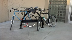
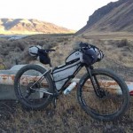
One of the 3 racks at Spokane City Hall that fill up when advocates appear before City Council.
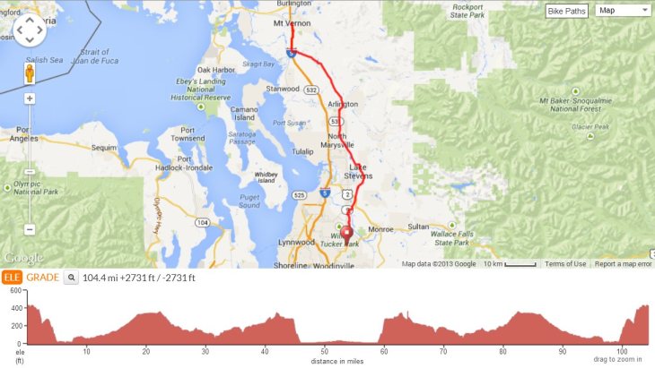
Want your city or county to be recognized for its bike-friendly qualities in the nation’s #1 Bike-Friendly State? How about a quick way to determine which local elected officials are bike-friendly or to give a few moments of publicity to someone you already knew makes a great ally? Ask them to sponsor a Bike Month proclamation.
Step 1) Download or copy our sample proclamation.
Step 2) Tailor it with the names of your local bike group, May Bike Month activities, supporters and partners who appreciate the value of bicycling for your community’s quality of life, health, and economy, and anything else that captures the unique experience of bicycling in your community.
Step 3): Take the proclamation to your mayor, city council, and/or county leadership and ask them to adopt it.
Step 4) Don’t forget to tell your friends on Facebook and alert the local media when a group of people on bikes plan to show up at a City Council meeting for a celebration of biking. You want those elected officials to be recognized and appreciated for their support.
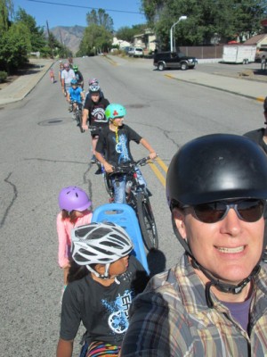
Additional things you can do: Consider organizing an informal ride to City Hall. Take pictures of people riding and those overflowing bike racks. And make sure you invite a variety of people from different backgrounds wearing all kinds of clothing to show that bikes are for everyone. (Looking for even more ideas? Check out our Bike Advocate Toolkit.)
Step 5) Come back and drop a link here to the local media coverage, minutes of the City Council, and what-have-you; tweet the link and tag us at @WAbikes; post it on our Facebook page; and email us.
We’ll shout out every town, city, and county in Washington that wants the positive reputation that goes with supporting and celebrating bicycling and add to the applause and acclaim.
Draft language in case the download file doesn’t work for you:
The City/County of ____
Proclamation
Whereas, the bicycle is a healthy, convenient, financially and environmentally sound form of transportation and an excellent tool for recreation and enjoyment of [insert city/county]’s scenic beauty, local attractions, and friendly neighborhoods; and
Whereas, throughout the month of May, the residents of [insert city/county] and its visitors will experience the joys of bicycling through educational programs, commuting events, Bike to School Day, trail work days, helmet promotions, charity events, races, or by simply getting out and going for a ride; and
Whereas, [insert city/county]’s road and trail system attracts bicyclists each year, providing economic health, transportation, tourism, and scenic benefits; and
Whereas, creating a bicycling-friendly community has been shown to improve citizens’ health, well-being, and quality of life, growing the economy of [insert city/county], attracting tourism dollars, improving traffic safety, supporting student health and learning, and reducing pollution, congestion, and wear and tear on our streets and roads; and
Whereas, Washington Bikes, [insert local bicycle club/ organization/chamber/tourism bureau], Cascade Bicycle Club, the League of American Bicyclists, schools, parks and recreation departments, police departments, public health districts, health care providers, companies and civic groups will be promoting bicycling during the month of May YEAR; and
Whereas, many of these same groups are also promoting bicycle tourism year round to attract more visitors to enjoy our local restaurants, hotels, retail establishments, locally produced foods and beverages, and cultural and scenic attractions; and
Whereas, these groups are also promoting greater public awareness of bicycle operation and safety education in an effort to reduce collisions, injuries, and fatalities and improve health and safety for everyone on the road;
Now therefore, I, _____, Mayor/Executive of [insert city/county], do hereby proclaim May YEAR as
Bike Month
in [insert city/county], and I urge all residents to join me in this special observance
Signed this ___ day of May, YEAR
Mayor/Executive _______________
- Sample-Bike-Month-Proclamation (Word document)
- Sample-Bike-Month-Proclamation (PDF)
 The 2016 state legislative session represented a time to assess and solidify gains following the 2015 legislative session. Last year
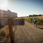


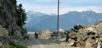 Show up and speak up for the John Wayne Pioneer Trail at
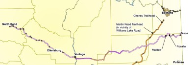
 January: We
 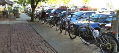 February: Dig into
  March: Move the Dead Red bill through the
  April: Look at
  May: We celebrate
  June: The legislature kept meeting, we kept working on transportation funding;
  July: The legislature finished a mere 176 days after it started (a new state record — the longest set of sessions in history). But we weren’t done making sure the
  September: We show the great work being done by
 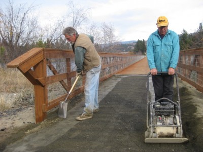 November: We’re delighted to report
  December: More great progress on bike connections to report in