Kidical Mass Growing in Washington

Photo credit: Link Transit

Photo credit: Link Transit

Parents who bicycle want to share the joy of riding a bike with their youngsters. Kidical Mass provides a fun, safe and social way to do it.

The first Kidical Mass ride occurred in 2008 in Eugene, Oregon, and it has quietly spread to over two dozen communities across the country. This year, Walla Walla and Wenatchee joined the ranks of Kidical Mass when volunteers started organizing local rides. You’ll find a list of Washington state communities (six that we know of) listed at the end of this post.

Walla Walla

Inspired by Kidical Mass rides in other communities, dads Luke Waggoner and Corren Current decided to organize one in Walla Walla. They created a Kidical Mass Walla Walla Valley Facebook page and set up a Twitter account to announce their first ride in April and were pleasantly pleased when two dozen participants turned out for the ride. They have been riding monthly.

“We set a date for our first ride and planned a route from Pioneer Park—one of Walla Walla’s best known parks—to a locally owned frozen yogurt place called Blue Palm. We started our second ride in the community of College Place and hope to regularly include both Walla Walla and College Place,” Luke explained and added, “We may even venture across the state line to Milton Freewater (OR) for a ride in a few months.”

He noted that the Walla Walla group plans to continue riding into fall.

Kidical Mass Walla Walla

Taking a break for frozen treats during the Walla Walla ride

Wenatchee

Kidical Mass Wenatchee Ride

Group selfie on the Wenatchee ride

Organizers Deb Miller, Todd Jensen and Patrick Tracy held their first Kidical Mass ride in June to coincide with Everybody Out(doors) Day. They have monthly rides scheduled through September, with the next one coming up on August 15. The organizers have been using flyers, word of mouth, and the Pybus Kids Century Facebook page to get the word out about their events.

Wenatchee is home to the much loved and heavily used Apple Capital Loop Trail, and Wenatchee Valley adopted a regional bike master plan a couple of years ago. The bike master plan process identified a high contingent of interested but concerned riders in the valley who either don’t feel safe biking on roads or are not aware of how best to access local bike routes.

“Kidical Mass provides an opportunity for families to ride and feel safer while riding in a larger, more visible group, helps them learn some of the easy connections between their neighborhood and local amenities, and teaches them a few road skills while we’re at it,” Deb noted. “Our hope is to help families identify these routes and then be able to access downtown, Pybus Market, Apple Capital Loop Trail, and other locations via bicycle and without driving to these locations in their cars.”

Kidical Massive: September 19

The founders of Kidical Mass are organizing the first ever Kidical Massive on September 19. They bill it as the biggest global family bike ride ever. (Added bonus: it’s also Talk Like a Pirate Day!) Among the Washington communities registered for Kidical Massive so far include Seattle, Spokane, Tacoma and Walla Walla. From the Facebook event:

Join us as thousands of families around the world go for a bike ride together. We’ll be showing that Kids are Traffic Too and that cities that plan for family biking are more livable, sustainable, profitable, and FUN! Make a ride in your community happen: register your community and start planning your event now.

Kidical Mass Washington State:

Seattle

Tacoma

Spokane

Thurston County

Walla Walla

Wenatchee

Are we missing your Kidical Mass rides or your Kidical Massive event? Please post it in the comment section!

Posted in Encouragement, Family biking, News, Rides | Tagged , , , , , | 1 Comment

Creating a Bicycle Friendly Ellensburg

Today’s post was written by Ellensburg City Council Member Nancy Lillquist.

Ellensburg bike rackSeveral years ago I was approached by a citizen who cycles with the suggestion that Ellensburg become an official Bicycle Friendly Community.  After looking at the application form, which at first glance appeared somewhat daunting, I decided not to pursue it.  Ellensburg citizens who cycle know we are friendly!  Why would we need the label?

Recently, I was approached again, this time by the Director of Tourism, Amy McGuffin.  She was looking at survey data showing that many people visit our small (18,000 people), central Washington college town for the great cycling.  She asked if I would help apply for the Bike Friendly designation as a way to promote cycling tourism.  A “stakeholders” meeting and several phone calls later, we submitted our application (it really wasn’t as difficult as I had imagined).  We were rewarded this spring with a “Silver” level Bicycle Friendly Community designation from the League of American Bicyclists!

Ellensburg is a naturally easy place to ride.  Settled in the late 1800’s, the City was platted in the traditional manner, with residential neighborhoods surrounding a central commercial center and a highly connected street network, making it easy to walk and bike in minutes to most services.  Many students attending Central Washington University take advantage of the relatively gentle terrain to get around by bike.  CWU has, over the years, created a large “auto-free” portion of campus.  The semi-arid climate is generally sunny and dry, though the snow and wind deter less committed riders winter and spring.  The 2010 Census reports 17% of our citizens walk and 8% cycle to work in Ellensburg.

The City of Ellensburg has been working for several years to make it even easier to bicycle around town. The City has focused on “Engineering” – providing infrastructure such as multi-use paths, bike lanes, and sharrows, including constructing segments of the John Wayne Trail reconnection and a path under I-90 connecting two parks.  In all, Ellensburg has 15 miles of off-street and 7.5 miles of on-street bicycle network.  We have collaborated to place five custom bike racks designed by local artists in our downtown and to promote bike events.  A large effort has gone towards updating our non-motorized transportation plan and subsequent changes to City Code including requirements for bike lanes on certain new streets and bike racks at new commercial developments.  Our police department receives bike training and has a bike patrol.  They also participate in helmet give-aways and share-the-road campaigns.

Ellensburg Trail Underpass

Recycle Shop weekly ride

Recycle Shop weekly ride

Beyond City government, the Ellensburg community has provided encouragement through fun events such as the Manastash Metric bike race and Whiskey Dick triathalon, as well as informal weekly rides organized by the local Recycle Shop and Ellensburg Mountain Bike Alliance.  The Ellensburg School District incorporates cycling into their fitness classes in middle and high school.  Younger children can participate in bike-to-school events and bike rodeos.

Ellensburg has a solid bike friendly base to build on, but there is always room for improvement.  We hope to turn our Silver into Gold in 4 years by making improvements in all areas – engineering, enforcement, education and encouragement – making Ellensburg an even friendlier place to bike for citizens and visitors alike.


Posted in Encouragement, Guest Blogger, Infrastructure, News, Tourism | Tagged , , , | Comments Off on Creating a Bicycle Friendly Ellensburg

Washingtonians Spoke Up for Biking, Health, and Safety and Governor Inslee Listened

Little girl on bike seen from te back, wearing helmet, others biking/walking in street.Today, Governor Jay Inslee announced a path to retain investments in the safety of our children on their way to school, special needs transit, and critical biking connections while moving forward on his agenda on reducing carbon emissions.

Washington Bikes thanks Governor Inslee for making the choice that retains Washington’s historic transportation investments in bicycling, health, and safety.

Over the past six months, thousands of caring Washingtonians asked state leaders in Olympia to make bold investments in our transportation future by making it safer and easier to bike and walk. They listened by investing $500 million in biking and safety projects in the transportation revenue package signed into law in July.

Over the past eight days, Washingtonians affirmed the need to save those same historic investments and Governor Inslee listened, too.

“When Washington bikes people are safer and healthier, and businesses thrive. We are heartened to hear that these historic investments for biking, health and safety will move forward,” said Washington Bikes’ Executive Director Barb Chamberlain. “Biking and walking investments are always investments in cleaner air.”

Over the past eight days, Washington Bikes highlighted what papers like the Seattle Times, Spokesman-Review, Everett Herald, and Tacoma News Tribune seconded: there’s broad, bipartisan, and statewide support for a once-in-a-generation opportunity to build bikeways and safer sidewalks for Washingtonians.

Numerous organizations and cities joined this call to action including American Heart Association, American Cancer Society, Foundation for Healthy Generations, League of American Bicyclists, Cascade Bicycle Club, Childhood Obesity Prevention Coalition, One America, Safe Routes to School National Partnership, Transportation Choices Coalition, and Transportation for America, among others.

“What is clear is that these investments go beyond protecting the environment,” said Washington Bikes Policy Director Blake Trask. “They make kids safer, they increase physical activity and health, and they grow local economies statewide.”

Thanks, Governor Inslee, for listening to the thousands of caring Washingtonians who want more investments in biking, health, and safer schools statewide.

Posted in Advocacy, Alert, Infrastructure, Issues & Advocacy, Legislature | Comments Off on Washingtonians Spoke Up for Biking, Health, and Safety and Governor Inslee Listened

What’s at Stake if Governor Inslee Cuts Historic Investments for Biking & Safety?

A review of what will be lost, if Governor Inslee eliminates historic investments in biking and walking safety.

Little girl on bike seen from te back, wearing helmet, others biking/walking in street.As was posted Monday, Washington Bikes is on high alert as the Governor Inslee has indicated he is considering eliminating historic investments in biking and walking. Since then, American Heart Association, American Cancer Society, Childhood Obesity Prevention Coalition, Transportation Choices Coalition, One America, and numerous local governments as well as health and mobility organizations across the state have asked Governor Inslee to not move forward on this executive action.

Add your voice and take action now to tell Governor Inslee to protect biking and walking safety investments.

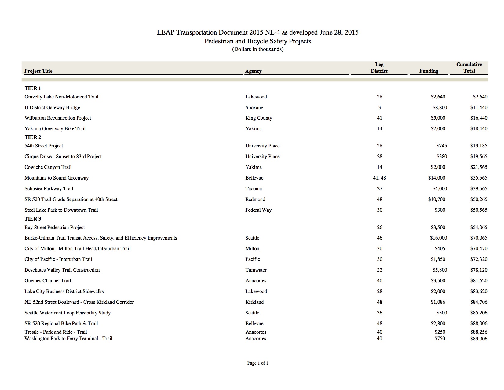
With over $235 million in direct biking and walking investments on the line, many have asked what projects are at stake. Roughly $104.5 million is identified for 25 projects statewide with the additional $130 million slated for competitive grant programs over the coming 16 years.

Governor Inslee threatens to eliminate all state Safe Routes to School funding.

Governor Inslee threatens to eliminate all state Safe Routes to School funding.

These investments, if allowed to move forward, would represent a stable base of funding that — with additional federal and limited state dollars — amounts to roughly $40 million each biennium. This type of long-term funding has never occurred in Washington state and at the July 15 bill signing represented a nationally significant investment in biking and walking infrastructure.

Identified Biking & Walking Projects in the Transportation Package.

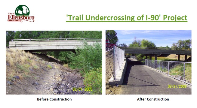
Below is the identified bike/ped project list that outlines 23 projects at $89 million. These are often regionally significant projects (and even statewide significance) that resolve real transportation issues across the state. The Burke Gilman Trail improvements at the University of Washington help a piece of transportation infrastructure that moves more people during peak hours than most roads in Washington state. The missing link of the Mountains to Sound Trail through Bellevue is another project, as is Spokane’s University District bike/ped bridge that will knit the neighborhood together.

LEAP-Bike-Ped

Other Critical Biking and Walking Projects

Also contained in the Transit Project List are two regionally significant projects:

  • $10 million for the Northgate Light Rail Station Bicycle and Pedestrian Overpass. This project will dramatically increase ridership for Sound Transit’s light rail network, and connects an Urban Hub (Northgate) to Northgate Community College and surrounding neighborhoods
  • $5.5 million for expansion of Puget Sound Bike Share to cities like Kirkland and Bellevue. This project will expand the nascent bike share program that is already looking to expand in Seattle.

Competitive Grant Programs

Also at stake for biking and walking? WSDOT’s competitive grant programs that fund critical biking, walking and school safety projects statewide:

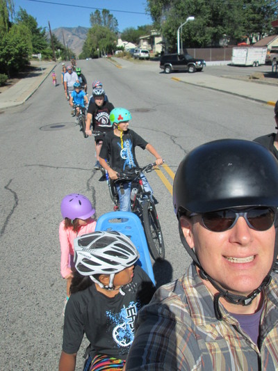
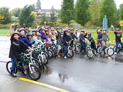
  • $56 million in Safe Routes to School funding that would (assuming past grant allocations) fund safety and wellness projects at 151 schools across the state.
  • $75 million in biking and walking safety projects that would (assuming past grant allocations) fund 150 safety and mobility projects statewide.

Other Critical Mobility Grant Programs at Stake

Beyond projects and grant programs directly benefiting biking, over $400 million in competitive grants are at stake through the Transportation Improvement Board’s Complete Streets Grant Program ($106 million), as well as the WSDOT Regional Mobility ($200 million) and Rural Mobility ($110 million) grant programs. In addition to the $400 million, $200 million will go to Special Needs Transit Grants statewide. Losing the Complete Street Grant Program would be a significant blow to creating safe and economically competitive streets across the state.

Also, this assessment does not include the loss of city and county investments that could go to street maintenance and other improvements that benefit everyone.

What Can You Do?

Clearly this decision will set the course for safety and mobility for years to come. Take action now and tell Governor Inslee to protect biking and walking safety investments.

If you’re on Twitter, after you complete the form use our Twitter tools below to highlight the project that matters most to you and ask others to take action. Remember — your town may have a project not listed here that would be eligible for future funding IF you take action and help fight for it now.

[Tweet “Act now to save historic investments in bike/walk safety & connection now/in future. #WAtranspo”]

[Tweet “ZERO in #SafeRoutes $$ #ForWAKids for 16 years? If @GovInslee signs exec order. Tell him no. http://t.co/Jl0QLxTenk http://t.co/VNVVsyHph1 “]

[Tweet “SAVE $4.5M for Anacortes #GuemesChannelTrail. Safe biking/walking, @wsferries access http://t.co/gBNIQnXxQA http://t.co/mk8Wj8PfuL “]

[Tweet “Tell @GovInslee SAVE $14M for @MTSGreenway Mountains to Sound Greenway #Bellevue gap http://ow.ly/Q1a2U “]

[Tweet “Tell @GovInslee to SAVE $1+M for #CrossKirklandCorridor! Take action here: http://t.co/yYEg6Ri466 http://t.co/SNmEc5mtWH”]

[Tweet “Tell @GovInslee $2.6M for Gravelly Lake Trail in Lakewood matters! http://ow.ly/Q1bMN “]

[Tweet “Ask @GovInslee to SAVE $405K for #Milton #InterurbanSouth. Take action here! http://t.co/1VWYCMR4BJ #Milton #WA http://t.co/L3pIf988Tw “]

[Tweet “Tell @GovInslee to SAVE $1.85M for #nterurbanSouth Trail in #Pacific! http://t.co/HVzILFKYzN “]

[Tweet “$3.5M for Mosquito Fleet Trail waterfront in Port Orchard at risk. Tell @GovInslee save it! http://t.co/7XNuG2EwBx http://t.co/RnpePzo9ae “]

[Tweet “Tell @GovInslee SAVE $2.8M for #SR520 #Bellevue connection! http://t.co/xIgeE66Fhg http://t.co/FgZPALRZeg”]

[Tweet “Tell @GovInslee $5M for Wilburton Reconnection critical to #EastsideRailCorridor http://t.co/zHkavVuVIF #trails http://t.co/Qcf2uLSZVm “]

[Tweet “#SR520 #Redmond 40th St safety project. Tell @GovInslee SAVE $10.7M! http://t.co/xIgeE66Fhg http://t.co/3iUs9P1IFU”]

[Tweet “Tell @GovInslee SAVE funding for #burkegilmantrail improvements. Act now: http://t.co/WQ9RGdINi0 @burkegilmantrl http://t.co/yTTPO60HQT”]

[Tweet “Let @GovInslee know you care about $8.8M for Spokane U District Gateway Bridge http://ow.ly/Q1bHn http://t.co/lMT3Y2PAmr #bikeSPO “]

[Tweet “Ask @GovInslee to SAVE $4M for Schuster Parkway Trail in Tacoma: http://ow.ly/Q19Wz http://t.co/adGe0irhmh #bike253”]

[Tweet “Ask @GovInslee to protect funds for #DeschutesValleyTrail in Tumwater. Take action! http://t.co/BADconOL4Z http://t.co/DlapZhNaHo”]

[Tweet ” Tell @GovInslee #UniversityPlace #WA needs $1.1M for its bike/walk safety projects! http://ow.ly/Q1aDC “]

[Tweet “Tell @GovInslee to SAVE $2M for beautiful Cowiche Canyon Trail in #Yakima http://t.co/KDO9Wjg1Dr http://t.co/Z5paGwfmBJ #bikeYAK #trails”]

[Tweet “Tell @GovInslee SAVE $2M for Yakima Greenway Trail! http://ow.ly/Q1aGV http://t.co/PjFCKVTbud #bikeYAK”]
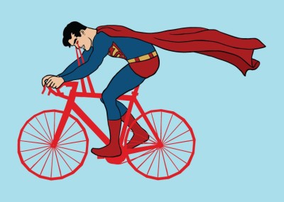
 

Posted in Advocacy, Alert, Complete Streets, Economic Impact, Funding/Policy, Infrastructure, Issues & Advocacy, Kids, Legislature, WSDOT | Tagged , , , , , , , , , , , , , , , | Comments Off on What’s at Stake if Governor Inslee Cuts Historic Investments for Biking & Safety?

Skagit’s Land O’ Lakes Loop

Skagit has tons to offer road cyclists with quiet country roads, a nice mix of flat terrain and rolling climbs, Cascade mountain views, and plenty of lakes, rivers and forests. Find more bicycle adventures on Washington Bikes’ Where to Ride page.

Baker
Distance: 52 miles
Elevation: 2065 ft
Good for: Beginners to Intermediate
Highlights: Farmland scenery, rolling climbs, mountain views, low traffic

Skagit County is famous for its colorful tulips and vast farmland. That alone probably makes it a worthy riding destination, but with quiet country roads, a nice mix of flat terrain and rolling climbs, Cascade mountain views, and plenty of lakes, rivers and forests, Skagit has tons to offer road cyclists. It’s no wonder the ALS Association’s Evergreen Chapter used to host their two-day fundraiser ride on the roads around Mt. Vernon each year. The fundraiser is now held in Snohomish County, but the roads are still out there for anyone to enjoy.

The Land O’ Lakes loop was traditionally day two of the ALS ride weekend. It takes you counterclockwise to the east of Mt. Vernon and has a little bit of everything that makes riding in Skagit so great. You’ll pass by a number of lakes, ride along farms on flat roads, parallel the Skagit River for a bit, and do just enough climbing to keep you honest.

The ride starts in downtown Mt. Vernon. Fuel up with coffee and a pastry at Ristretto Coffee on 1st Street, or grab some snacks at the ever-wonderful Skagit Valley Food Coop just a block off your route. As is often the case with urban riding, when you start you’ll have to do a bit of a zig-zag to get out of town. Head north on 1st, take your first right on Montgomery, then your next left onto 2nd. You’ll climb up a gentle bridge grade to get over I-5.

After you cross the bridge, take a right on Fulton St then your second left on 6th Ave.  When 6th Ts into Division hang another left. After .3 miles on Division take a right on 13th Ave. Stay on 13th for 1 mile. Take a right on Blackburn Rd then take your second left onto Cedardale Rd. (You’re almost out of town!). Cedardale parallels the freeway and is noisy, but it’s nice and flat and passes along a few farms.

After 1.6 miles, take a left onto Hickox Rd then your immediate next right onto Burkland Rd. When Burkland Ts into Johnson Rd at mile 6 take a Right then take a Left to get back on Cedardale. When you reach WA-534 at mile 7.6, take a left.

This is where the ride really starts getting great. You’ll climb up into the forested foothills for a few miles and quickly get a taste of rural Skagit County. You’ll be sweating uphill for a few miles, but you’ll be rewarded with a fun descent at Lake McMurray.lakes

After 5 miles on WA 534, take a left on WA 9 (mile 12.6). Though it is a state highway, there isn’t much traffic to worry about. This stretch of WA 9 has lots of fun rolling climbs, nice views of the lake, and opens up back up into lovely farmland. After 3.6 miles take a left onto Big Lake Blvd (mile 16.2).

As the name indicates, Big Lake Blvd takes you along the western shore of Big Lake and into the small, unincorporated community of the same name. Stay on Big Lake Blvd for 4.4 miles. Take a left to get back on WA 9. Stay on WA 9 for 2 miles then hang a right onto Knapp Rd. You’ll ascend a punchy little climb up Knapp, then hang a left onto Baker Heights Rd. After .7 miles on Baker, take a right on Gunderson. Stay on Gunderson as it curves 90 degrees around a bend. There are a few more punchy rollers before Gunderson rewards you with a nice long downhill. You’ll ride for 3.5 miles past more farms and forest and continue straight as Gunderson becomes Beaver Lake Rd where the road continues to point down hill for a while. At mile 29.2 take a hard right to stay on Beaver Lake. After another 1.8 miles take a sharp left to stay on Beaver Lake again. Ride 1.3 miles then take a right onto Front St.

Front St Ts into WA 9. Hang a right into the small town of Clear Lake. If you need to stop for re-supplies, the Clear Lake Market will be on your right a few blocks up. As you reach the edge of town (all several blocks of it) the road Ys. Stay right on Front St then take a right again on Old Day Creek Rd.

farm

Old Day Creek leads you straight into the biggest climb of the ride. Three miles long and nearly 600 feet of elevation gain, it’s definitely a bit of a grunt. But put your head down, keep the pedals turning, and rest easy knowing the ride is nearly flat all the way back to Mt. Vernon once you’re up and over this hill. Once you’ve crested the hill, enjoy the descent back off the other side all the way to the Skagit Hwy at mile 38. When you reach Skagit Hwy, take a left. It will take you along the Skagit River for 5.5 miles before curving you back onto WA 9.

When you reach Hwy 9 take a right and head back towards Clear Lake. You’ll briefly backtrack through town before taking a right on Mud Lake Rd at mile 44.8. Stay on this for 1.8 miles then take a right on Swan Rd. Swan Ts into Francis Rd at 48.4. Take a left. Continue straight on Laventure Rd at 49.2 then take a right on Fir St at 50.4. You’re almost done!

Continue on Fir for 1 mile then take a left onto 4th St. This will take you back across I-5 and down the hill into downtown Mt. Vernon where there a bevy of places to grab a post-ride meal. If, like many cyclists, you enjoy a post-ride pint, the Skagit River Brewery  is waiting for you at the corner of 3rd and Montgomery.

cows

Posted in Adventure, Economic Impact, Events, Rides, Rural, Skagit County, Tourism, Travel | 1 Comment

Governor Inslee is Threatening a Once-In-A-Generation Opportunity – Tell Him to Stop

Washington’s historic transportation investments in bicycling, health, and safety are in jeopardy because of potential action by Governor Inslee on a low carbon fuel standard. It doesn’t have to be this way. Take action today.

Over the past six months, thousands of caring Washingtonians like you have asked state leaders in Olympia to make bold investments in our transportation future by making it safer and easier to bike and walk.

Governor Inslee threatens to eliminate all state Safe Routes to School funding.

Governor Inslee threatens to eliminate all state Safe Routes to School funding. Tell him to stop.

Our leaders listened, but now Governor Inslee threatens to take away this once-in-a-generation opportunity to build bikeways and safer sidewalks for Washingtonians.

Tell Governor Inslee to protect biking and walking safety investments – take action today!

Just a few days ago, Washingtonians were told historic investments had been made in creating safe streets, new sidewalks and bike pathways for our school kids and communities. Now they’re being told those investments could be wiped away through a potential action by the Governor on a low carbon fuel standard. There doesn’t have to be a choice between safer and healthier communities and climate change – Governor Inslee knows he has other avenues to implement his climate change agenda. This isn’t it.

According to the Seattle Times, Governor Inslee is considering eliminating all our hard-won future state investments for Safe Routes to School, as well as $235 million for biking improvements statewide.

All told, almost $2 billion in special needs transit, rural transit, King County transit, environmental improvements, and walking and biking are on the line.

We don’t need to trade the safety of our kids at schools, special needs transit, and critical biking connections for lasting action on climate change – we can have both. This is a false choice driven by politics in Olympia.

It’s all up to Governor Inslee.

Tell Governor Inslee today to protect biking and walking safety investments so we can fulfill our promise to help every child grow up healthy and to create safer biking connections.

Posted in Advocacy, Alert | 6 Comments

Mount Rainier Bike and Hike: Indian Henry’s Hunting Ground

Mount Rainier - Indian Henrys

I love Mount Rainier National Park and I feel incredibly fortunate to have this natural wonderland in my back yard. An active volcano and the highest peak in Washington state, the mountain dominates the landscape for many of us. For me, the park is a year round destination to hike, bike, ski, and stay connected to nature.

The park is home to subalpine meadows that produce an amazing display of wildflowers, and this is what lures me there in the summer. I recently visited Indian Henry’s Hunting Ground—one of my favorite wildflower meadows at Mount Rainier—but this year I incorporated a bike ride into my approach. Yes, a bike ride. Instead of hiking to Indian Henry’s on the Kautz Creek Trail, my usual approach, I biked up the closed-to-motor-vehicles Westside Road to access the Tahoma Creek Trail and Wonderland Trail to the meadow.

Mount Rainier Westside RdWestside Road was once part of a grand vision to encircle Mount Rainier with a road but lack of funds, challenging topography and repeated washouts killed the dream. Today, vehicles can only travel the first couple of miles of road. The remaining nine miles of Westside Road, which ends at Klapatche Point, is now accessible to hikers and bikers only.

Use the Nisqually entrance via the community of Ashford to the park. It will cost you $20 if you enter with a motor vehicle and $10 per person if you arrive by bike. (Park fees and passes info here.) Look for Westside Road on your left about a mile after the park entrance.

You’ll only ride a couple of miles up the road before you switch from biking to hiking, but it’s a pretty ride. It’s a wooded ride with views of Fisher Creek and a peek at Mount Rainier. You’ll want fat tires for the ride. The road is not paved, rough in spots, and you have a water crossing. As you approach the first switchback, look for the unsigned Tahoma Creek Trail on your right. Walk a short distance in and find a place to stash your bike. Be sure to bring a cable lock to secure your bike to a handy tree.

Pyramid Peak at Mount RainierNow the hiking begins. The Tahoma Creek Trail, two miles in length, is unmaintained and washed out in spots. At a trail junction, follow the Wonderland Trail to cross Tahoma Creek on a suspension bridge and climb the flank of Mount Ararat to the fairy tale meadows of Indian Henry’s. Wander among the wildflowers to the historic ranger cabin. Follow a path to Reflection Lake, Pyramid Peak and more stunning wildflowers. Listen for whistling marmots and singing birds. Watch for bears.

When you’ve had your fill of wildflowers and Mount Rainier views, retrace your steps back down to your waiting bike. You can practically coast back to your car and load up your bike.

Ready for a post bike and hike food stop? Check out the historic Copper Creek Inn in Ashford. Burgers, pasta, stew, salads, and more are on the menu. And don’t miss their popular blackberry pie!

August 14, 2014 Update:

Westside Road is temporarily closed due to a glacial outburst that rumbled down Tahoma Creek. Please consult Mount Rainier National Park at nps.gov/mora for current conditions.

Posted in Rides | Tagged , , , | Comments Off on Mount Rainier Bike and Hike: Indian Henry’s Hunting Ground

The Magic of Bike Camping at Fay Bainbridge Park

Fay Bainbridge Park is perfect for weeknight adventures and a great spot to discover (or help your friends discover) bike traveling magic for the first time.

Fay Bainbridge State Park Moon
Distance: 14.2 miles (round trip)
Elevation: 1,083 feet (round trip)
Highlights: easy overnight bike camping, beach-side camping, views of Rainier and the Cascades, weeknight camping

Bike touring is a special thing. It provides a sense of adventure, an escape from routine, and the unique satisfaction of traveling by your own power. And while long-distance touring has its own rewards, it only takes an overnight trip to capture a little bit of that bike travel magic.

Luckily for Seattlites, there is a laundry list of nearby campgrounds to choose from for easy adventures. Of those options, Fay Bainbridge Park on Bainbridge Island is about as easy as possible. It is a mere 7 miles of pedaling from the ferry dock to the park, there’s easy access to grocery stores for your campground feast, the campsites are right on a Puget Sound beach, and on clear days there is a terrific view of Mount Rainier. It is a gem of a resource for novice and experienced bike campers alike.

The adventure starts in downtown Seattle at the Seattle Ferry Terminal. Take the 35 minute ferry ride to Bainbridge Island. When you get off the ferry, head north on Olympic Drive. When you reach the first major intersection with Winslow Way head right to continue towards Fay Bainbridge or left if you need to stock up on provisions. The Town and Country grocery store is a few blocks up Winslow on your left.

Continuing towards the park, head .4 miles down Winslow and take a left onto Ferncliff Ave. At mile 2.1 Ferncliff curves left and becomes Lofgren Rd. After another .4 miles, Lofgren curves right onto Moran Rd. Continue on Moran until it Ts into Madison Ave. Take a right on Madison then your immediate next right on Manitou Beach Dr.Bainbridge Island Road

Continue on Manitou for 1.3 miles until it curves left and becomes NE Valley Rd. After .3 miles on Valley, take a right on Sunrise Dr. Continue on Sunrise Dr. for another 2.5 miles. The entrance road to Fay Bainbridge will be on your right at mile 7.1.

Fay Bainbridge has 42 campsites including three sites specifically for people arriving by bike, foot, or kayak. Starting summer 2015, most of the campsites can be reserved in advance by calling 206-842-2306 x118 during business hours. 12 of the sites will still be available first come first served along with the hiker biker specific sites.

When you’re ready to head home, just retrace your turns back to the ferry. If you don’t time things right or just aren’t ready to head back to reality, downtown Winslow has lots of great coffee shops and restaurants. The cash-only Blackbird Bakery at Winslow Way and Madrone Lane has spectacular pastries.

Bike camping can’t get easier than a trip from Seattle to Fay Bainbridge which makes it perfect for weeknight adventures and a great spot to discover (or help your friends discover) bike traveling magic for the first time.

Rainier_Fay


Update: This post originally referred to Fay Bainbridge State Park. Thank you to those of you who let us know it was transferred to City of Bainbridge Island and is no longer a state park.


Posted in Adventure, Bike Camping, Family biking, Ferries, Kitsap County, Tourism, Travel | Tagged , , , | 3 Comments

Bike Theft: Don’t Be a Victim

Today’s post is written by life member Kristi Knodell of Marysville. She is the Shop Manager for Sharing Wheels, a community bike shop in Everett. She offers up tips to prevent bike tips and advice on recovering a stolen bike. This post first appeared on Sharing Wheel’s blog.

“My bike was stolen.”

A day does not go by without hearing about someone losing their bike to a thief. Every one insists they had their bike locked up but I suspect they wouldn’t admit otherwise.

Bike theft in Everett and Snohomish County is on the rise. Some thieves are trying to get from point A to point B and sees an opportunity to do it easier and faster than walking. They often abandon the bike after getting to their destination. Some of the thieves sell the bikes or trade for something they want, usually for pennies on the dollar. And sadly, some thieves turn the aluminum or steel bikes into scrap for pennies per pound.

Many of us use our bikes for transportation to work, grocery shopping, school and anywhere else we want to go. Some of us have transportation choices and also have cars or trucks but choose to use our bikes, opting for an affordable and healthier way to travel. For some of us it is our only means of transportation, lacking the financial, legal means or desire for a motor vehicle.

Losing a bike can be especially hard on those with limited resources. Replacing what is taken can be hardship.

It sounds silly but we have special bonds with our bikes. They give us the ability to move great distances under our own power, allowing for self-sufficiency.

Those who steal bikes are heartless, the scum of the earth. There are movies produced on the theme of bike theft: Beijing Bicycle, Pee Wee’s Big Adventure and The Bicycle Thief. All depict how much the victims loved their bikes and illustrate the great efforts they are willing to make to get their bikes back.

Sharing Wheels does not buy or trade bikes. We have a strict policy we adhere to in order to prevent accidentally obtaining stolen bikes. We rely strictly on donations. Some other bike shops and of course pawn shops buy bikes, making a great outlet for the thieves. The pawn shops are supposed to submit the serial numbers to the local police. There is no one database storing the reported thefts, allowing thieves to travel to neighboring cities and unload. These shops pay pennies on the dollar, begging the question, why would someone sell “their” bike for so little. By purchasing from these shops you contribute to the problem, creating a demand for stolen bikes.

There are some online bike registries. The  National Bike Registry and  Project 529 are two such sites. The City of Arlington Police Department also has a Bicycle Registry  program. Check these programs out if you want to register your bike.

serial numberDo the police care? Maybe, maybe not. But there is nothing they can do if you don’t report the theft. Only 56% of thefts are reported (I read that somewhere). When you make a report, you need to have some information from your bike that you write down before it is stolen.

Almost all bikes have a serial number, usually located on the bottom bracket (the cylinder-looking thing that the cranks and pedals come out of). Write down the serial number, make, model, and color and put it in two different safe places with a good photo of your bike. That number is the one thing distinguishing your bike from other bikes, like the VIN for a car. Without it, there is not much to be done.

To avoid having to use this information, it’s important to prevent a theft. Some places you can bring your bike inside (hopefully your home is one of them). But even being inside doesn’t guarantee you will have your bike when you return. Open or unlocked garages can be an easy target. The more locks you can afford the better. Thieves are generally looking for the easy target, but they are getting more sophisticated. Check out Hal Ruzal of New York City on how to properly lock up your bike .

To a Northwesterner,  New York city can seem like a crime mecca and Hal’s advice may seem appropriate for NYC, but what about here in Snohomish County? As I said, a day does not go by without me hearing about someone losing their bike to a thief.

Sign up for our bike e-news!


Posted in Education, Guest Blogger | Tagged , | Comments Off on Bike Theft: Don’t Be a Victim

Experience the Olympic Discovery Trail – Part 2

Port Angeles to the Pacific Ocean

Deborah Anastasi Black is a public relations consultant specializing in results-driven media relations, marketing communication and project management. She focuses her practice on Washington’s Olympic Peninsula region, where she works with clients in the wine, culinary and tourism industries.

Summer is a fantastic time of year for two-wheeled adventure in the Pacific Northwest. Whether you’re an expert cyclist or simply enjoy riding with the kids on a sunny day, the Olympic Discovery Trail is a great place to take your wheels for a spin. Start with breakfast in historic Port Townsend, peddle through lavender fields in full bloom in Sequim, and meander along coastal shores in Port Angeles. Or if mountain biking is more you’re speed, you’ll want to check out the Adventure Route adjunct to the trail. Along the way, there is plenty of opportunity to stop for a cool drink, take in a scenic attraction, visit a farmer’s market, and more. Extend your trip with an overnight stay at a local campground, hotel or B&B. The Olympic Discovery Trail offers something for everyone!

Yesterday we traveled the trail from Port Townsend to Port Angeles. Today our journey resumes in Port Angeles and takes us to the Pacific Ocean.

West Central

The West Central section of the Olympic Discovery Trail is 31.7 miles long, running from Port Angeles across the Elwha River, and continuing to Lake Crescent. Approximately half of the distance is comprised of separated trail; the other half is roadway.

Beyond Port Angeles’ historic downtown, the trail continues out Ediz Hook, a three-mile long sand spit that extends northeasterly into the Strait of Juan de Fuca approximately 15 miles west of the Dungeness Spit, forming the natural harbor in Port Angeles. Orcas and Harbor Seals can be sighted to the north, depending on the time of year.

ODT crossing Elwha RiverThe end of the spit is occupied by the Coast Guard Air Station, which is closed to the public. The Ediz Hook Lighthouse, also located at the end of the spit, helps ships to safely maneuver the surrounding waters.

Retracing the path back to the mainland, the ODT traverses city streets and packed dirt railroad grade to the Elwha River. There it crosses a suspended bridge below a car deck with views of the river and flood plain below.

West beyond the bridge, the trail follows a temporary route toward Lake Crescent and the Pacific Ocean along Elwha River Road to State Hwy. 112. 

ODT Adventure RouteAttraction: Mountain bike enthusiasts will be interested in the Olympic Adventure Route adjunct to the ODT, which can be accessed on the west side of Hwy. 112, one quarter mile past the Elwha River Bridge. The Adventure Route consists of 21 miles of single track and four miles of logging road running from the west side of the Elwha river to the east end of Lake Crescent, offering spectacular views. Intended for hikers and equestrians as well, the terrain is hilly and forested.

There are three additional access points with roadside parking along different segments of the Adventure Route. These include the Joyce Access Road crossing, the Joyce-Piedmont Road crossing and Olympic National Park East Beach Trailhead.

Continuing through the town of Joyce en route to Lake Crescent, the route crosses the Lyre River and enters the Olympic National Park trailhead. This trail follows the route of the Spruce Railroad, which was originally built during WWI to carry spruce logs out of the forest for airplane manufacturing. It follows the north shore of serene Lake Crescent for about four miles, ending at the intersection with Hwy. 101. 

Point of Interest: Historic Lake Crescent Lodge, formerly known as the Singer Tavern, is located on the lake’s south shore. Built in 1914 by Avery and Julia Singer, the lodge was purchased by the National Park Service in 1951. Five of the original rooms in the main lodge are still in use; additional lodging includes 10 cabins and modern motel-style units. The lodge restaurant serves breakfast, lunch and dinner from early May to January 1. Recreational activities include hiking, fishing and boating. 

West End

The final 41.6 mile section of the Olympic Discovery Trail, which ends at the Pacific Ocean, is not yet constructed. Those who wish to cycle to the ocean beaches can follow a temporary route along U.S., State and County paved roads to the community of Forks and onward to the beaches of the Pacific Ocean at La Push.

For more information on the Olympic Discovery Trail, visit http://www.olympicdiscoverytrail.com or call the Port Angeles Regional Chamber of Commerce at 360.452.2363.

Washington Bikes has a small supply of Olympic Peninsula bike maps (includes portions of the Olympic Discovery Trail) available. These maps cover the northern peninsula from Port Townsend to Port Angeles. Please complete this form if you would like to receive a map set.

First
Last
Sending

Posted in Travel | Tagged , , , , , , | Comments Off on Experience the Olympic Discovery Trail – Part 2