Snohomish County Bikes: Promising Work on The Whitehorse Trail

Since the Oso Landslide there have been encouraging things happening on the Whitehorse Trail, on the ground and in the news. Snohomish County Bikes: an ongoing series highlighting great Snohomish County bike rides, issues, and events.

Note: This post was originally published by the Centennial Trail Coalition of Snohomish County and written by its board secretary and Darrington resident, George Winters.

Whitehorse Trail

Whitehorse Trail spur off of the Centennial Trail. Photo by Debora Nelson

Completing the 27-mile Whitehorse Trail will connect Arlington and Darrington through the stunning Stillaguamish Valley and will tie into the Snohomish County Centennial Trail system. Activity to complete the Whitehorse Trail has gained traction in response to the SR 530 slide near Oso. As the residents of the Stillaguamish Valley seek to recover from the tragedy, completing the Whitehorse Trail serves as one economic redevelopment strategy to attract bike travel and tourism to the area.

Snohomish County’s recent purchase of the Snohomish County section of the Eastside Rail Corridor means that with adequate funding, a dedicated trail network from cities like Seattle and Kirkland will ultimately extend over 70-80 miles north up to Darrington. The Whitehorse Trail holds the promise to become a bike travel and tourism destination providing non-motorized access to some of the greatest Cascade Mountain vistas and wilderness in Washington state.

Securing funding in the upcoming state legislative session will be necessary for the trail’s completion. Washington Bikes is committed to working with local, county, state and federal partners to ensure coordination and funding makes this incredible regional asset a reality. Already Washington Bikes has worked at the Puget Sound Regional Council level, with multiple state grant programs, and with partners from across jurisdictions. We will continue to do so moving forward.  -bt

There have been encouraging things happening on the Whitehorse Trail, on the ground and in the news.

On June 20th, the last day of Spring, what one might call Summers Eve, I found an ambitious crew working away on the Whitehorse Trail near Fortson Mill Ponds. Snohomish County has hired several summer work crews as part of a community development plan.

This area of the Whitehorse Trail, popular with fisherman and bird watchers, has been in desperate need of brushing, and now there are people on the ground doing just that:

Whitehorse Trail

The trail near Forston Mill Pond is much wider than I realized, now that a crew has been out removing the old growth salmon berry and invasive weeds.

Now you can find the trail.  There is also new gravel on the access road.   The photo above shows the huge improvement compared with what the trail looked like before, which was similar to the photo below.

Whitehorse Trail

This is what an untended section of the Whitehorse Trail looks like just west of Swede Heaven Road.

There was only a small contingent of the work crew present when I encountered them, but the enormous effort and accomplishment in the past week is quite evident.  I have heard encouraging rumors of other improvements in the works: bridge decking and proper gates at the road crossings.  I look forward to future trips watching the progress.
Whitehorse Trail

With the new brush removal, the views of the river have improved.

Thank you Snohomish County.

This news in the Everett Herald recently: County awards $6.4 million contract for Oso debris sifting

The article is mostly about the progress of re-opening SR 530, but also of note, it states:

“The contract also calls for clearing portions of the Whitehorse Trail, a former rail corridor roughly parallel to Highway 530.”

It is good to hear that the County is committed to this additional luxury along with all the needed restoration work. The Oso Slide has created many huge needs.  Helping families recover, and re-establishing full road access to Darrington are the current priorities, but the future of the Whitehorse Trail is still a promising work in progress.

Sign Up to Receive Updates on Biking in Snohomish County

First
Last

Posted in Advocacy, Arlington, Darrington, Economic Impact, Funding/Policy, Infrastructure, Issues & Advocacy, Legislature, News, Oso, Rural, Snohomish County, Tourism, Trails, Transportation | 1 Comment

Even local bike travel can take you far from the familiar

Why do we travel? Often, to see something different, or have new experiences, or for some of us even to have adventures. You might think that the farther you go, the bigger the adventure or the more amazing the experience, but that’s not necessarily so.

I was reminded of this recently while on a bike ride from Seattle to Spokane with about 40 people, arranged cooperatively between the Spokane Bicycle Club and Cyclists of Greater Seattle (COGS).

An inspiring variety of sights and sites are available right here in Washington, and what better way to travel amongst them than on a bike.

1-uptoskykomish

We left on a wet Monday morning, and as long time West of the mountains people know, June is pretty much an even call on whether it will be sunny. As it happened, we rolled out in the mist. However, it also rarely rains hard here, so it’s not like it was a hardship. We followed parts of the RSVP and Flying Wheels routes until we got to Monroe, and then joined Highway 2 for the journey out to Skykomish, our first stop for the night. At the campground, my campsite was surrounded by trees, some of which had diameters twice the length of my bike. Even though it rained most of the night, the branches provided such a solid canopy that few raindrops actually touched the tent.

Day two brought our climb up to Stevens Pass. It was predictably wet, but the road shoulders were generally wide, and short detours onto the Old Cascade Highway presented pristinely quiet wilderness. Once we topped the pass and started down the mostly downhill leg to Leavenworth, conditions changed from cool and wet to gradually warmer and, finally, the sun broke out along with that way that east of the mountains smells different, and the dense forest became more widely spaced Lodge Pole pines.

2-sunrise

On a bike, you are more likely to visit small towns you’d never see from the Interstate. We overnighted in Quincy, where the owners of The Idle Hour restaurant actually closed for the evening just to serve us. Later in the ride, we nearly filled a Mexican restaurant for dinner in Davenport, and it was something to see the confused faces of people walking in from a nearly empty parking lot to find the place bursting at its seams with people.

Of course another facet of travel that becomes more special on a bike is the feeling you get for the physical topography of the land. Out of Quincy we climbed slowly via snaking remote roads up to a place called Pinto Ridge, which it turns out, is the highest point in Grant County. Sure, it was warm and slow, but then comes the reward for what you just invested. There’s nothing like watching the terrain unfold in front of you while coasting at whatever speed you’re comfortable, ever deeper into the coulee, spotting the blue water as it first peeks out of the rock and brush, as well as the cooler air that replaces what you just sweated through.

3-canolaflowers

After Coulee City, we rejoined the now mostly straight Highway 2 for the final eastward legs to Spokane. Thanks to a generous tailwind it felt almost downhill, and because it’s early summer, the colors are brilliant. For some of us, the start of the trip was familiar “back yard” territory, and for the other half it was the other way around, and for a couple who came from out of state to ride with us, it was all new. Riding with new friends helps you see the familiar in new ways, and to appreciate the richness that we have right here in our mutual backyards.

As a postscript, I’d like to add that because I wanted to end up in Cheney, I took off solo down the Fish Lake Trail out of Spokane, which gets you halfway there before you need to jump back up to the highway. It is a jewel, smooth pavement that takes you right out of town and into quiet forest with a view of the Marshall Creek valley. Between this and the Centennial Trail that takes you out to Coeur d’Alene, the Spokane area has some wonderful trail riding opportunities.

If you would like to receive a cue sheet of Kevin’s cross-Washington ride, fill out the info below and we’ll send you one!

Posted in Adventure, Bike Clubs, Economic Impact, Rides, Tourism, Travel | Tagged , | 4 Comments

Last Week to Comment: Does Your Safety Count?

If they don’t count, it doesn’t count. Unfortunately in Washington state and on the federal level, no requirements exist to develop strong robust performance measures around non-motorized safety. Comment before June 30 to tell the US Department of Transportation that Safety Counts!

As cyclists, we know about safety. It’s a constant topic of conversation: how best to be seen, the best route to take, and words of concern (“bike safe!”) we often hear from friends and family before a ride.

Yet despite all the talk and worry about bicycling safety, there’s rarely accountability at the state and federal levels of government to find solutions to prevent bicycling injuries or deaths.

In Washington state, while serious injuries and deaths are on the decline for many motor-vehicle  incidents, we’re falling short of our state’s “Target Zero” goal of zero deaths and serious injuries by 2030 for those that walk and bike.

Their safety needs to count, too. pedbikeimages.org/M. Cynecki

Their safety needs to count, too. pedbikeimages.org/M. Cynecki

Now’s your last chance to begin to change this. The US Department of Transportation is now in its final week of accepting comments on its plan to measure whether or not the nation’s transportation system is working for all Americans.  Unfortunately, its first draft fails to include any goal, accountability, or requirements to reduce the 16% of all fatal crashes that include people who bike and walk.

Tell the US Department of Transportation  that safety counts and improving bicycling safety should count, too.

The US Department of Transportation needs to hear from you today. Let them know that safety for bicycling counts.

In addition to their helpful letter writing tool, the League of American Bicyclists has provided additional background on why we need to do better to count bicyclists and improve our transportation system for everyone.

Posted in Advocacy, Alert, Federal, Funding/Policy, Issues & Advocacy, News, Safety, Transportation | Comments Off on Last Week to Comment: Does Your Safety Count?

Coming Soon: Amtrak Roll-On Bike Service

Bike_Amtrak - cropped - Don Willott

Photo by Don Willott

Have you dreamed of traveling to a distant state by train with your bike, but cringed at the thought of having to box your bike for the journey? Dream again. Amtrak roll-on bike service is on its way!

Amtrak announced plans to include bike storage racks on its new long distance equipment. The new baggage cars will be installed on all 15 long distance routes by the end of 2014. That includes the Coast Starlight and Empire Builder routes serving Washington state.

“It’s clear that Americans want a national system of intercity passenger rail and Amtrak is moving ahead to build new equipment to meet customer demand,” said Amtrak President and CEO, Joe Boardman.

Washington Bikes executive director Barb Chamberlain is looking forward to switching to trains for her long distance travels.

“Roll-on bike service will make me choose Amtrak over air travel every chance I get. I’ve been waiting for this to transform my vacation choices. This will open up a huge market for Amtrak since bike travel is growing like crazy and legs sometimes need a rest,” she stated.

Bicyclists traveling by train in western Washington and Oregon have been accustomed to roll-on bike service on Amtrak Cascades service sponsored by WSDOT and ODOT. All Amtrak routes in Washington will have roll-on bike service with the expansion to Coast Starlight and Empire Builder routes.

Read complete story from Amtrak blog.

Sign-up for E-News

First
Last

Posted in Accessibility, Economic Impact, News, Trains, Transportation, Travel | 5 Comments

Snohomish County Bikes: Country Riding on the Everett-Lake Roesiger Loop

Snohomish County Bikes

Snohomish County Bikes: an ongoing series highlighting great Snohomish County bike rides. Share your own great ride with us here!

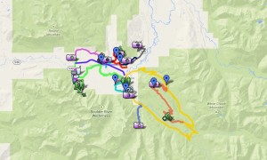
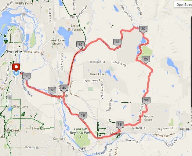
Location: South Snohomish County [Approximate Route Map]
Distance: 52 Miles
Elevation gain: 2,000 Feet
Good for: Intermediate road riding
Highlights: quiet roads with low traffic, good scenery, mostly flat

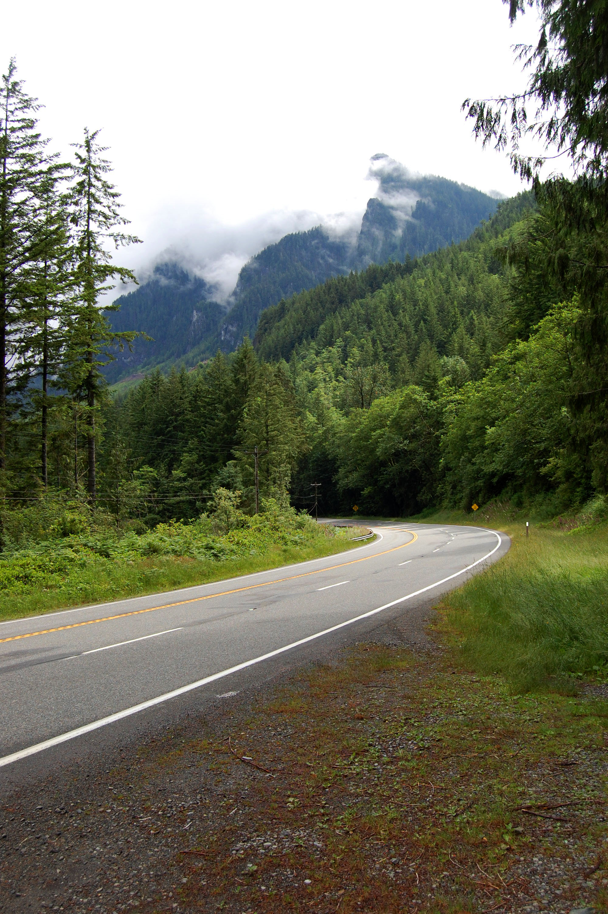
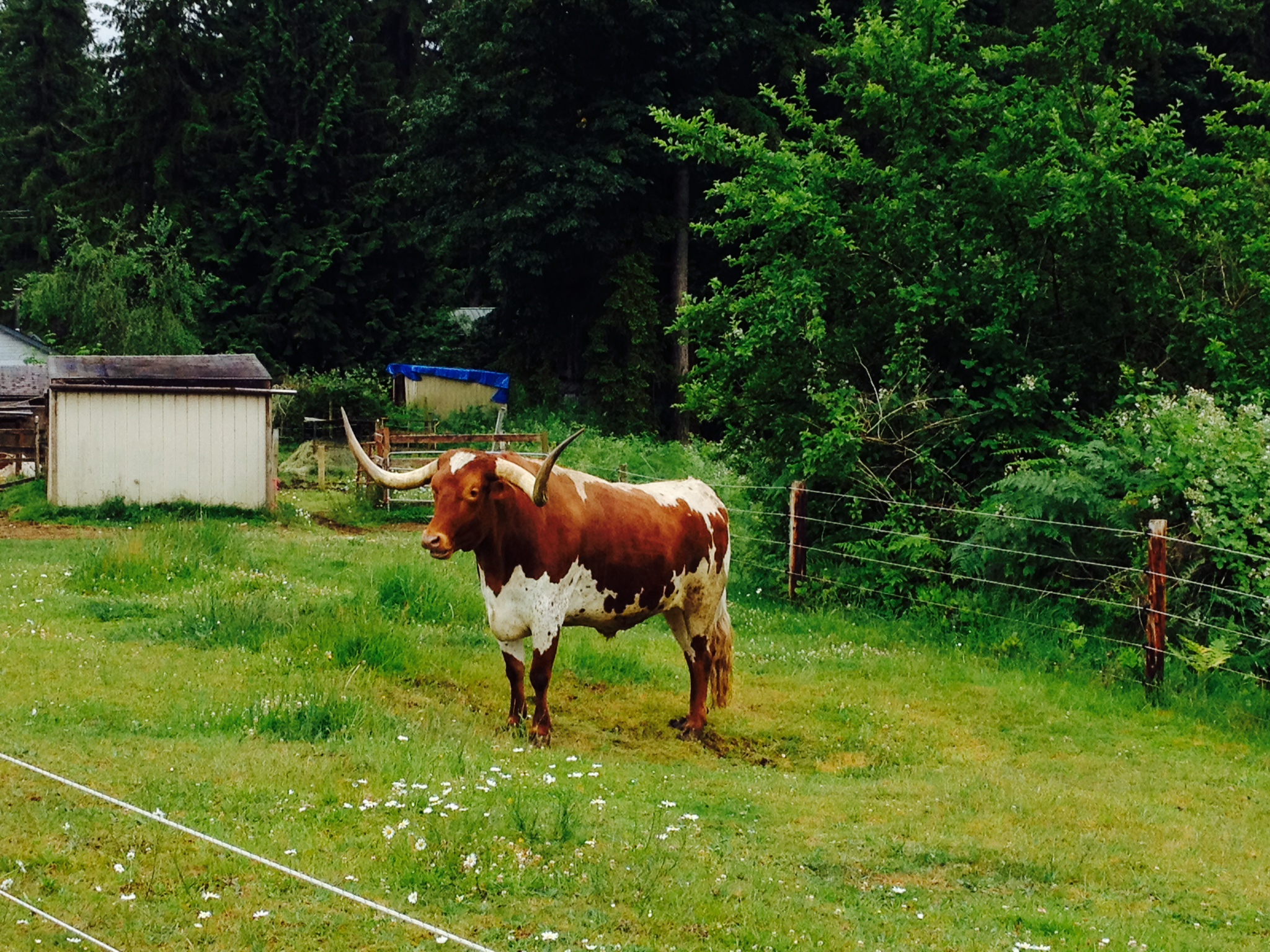
Snohomish County is home to over 1,500 working farms. And though the county lines encompass everything from the shores of Puget Sound to remote mountain wilderness, farmland is a dominating feature of the landscape and, as such, the dominating scenery of about any good road ride in the area.

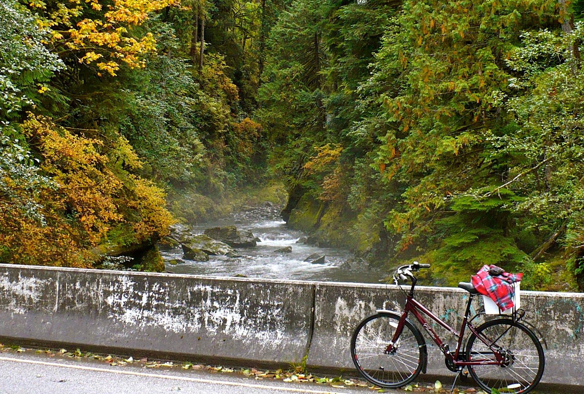
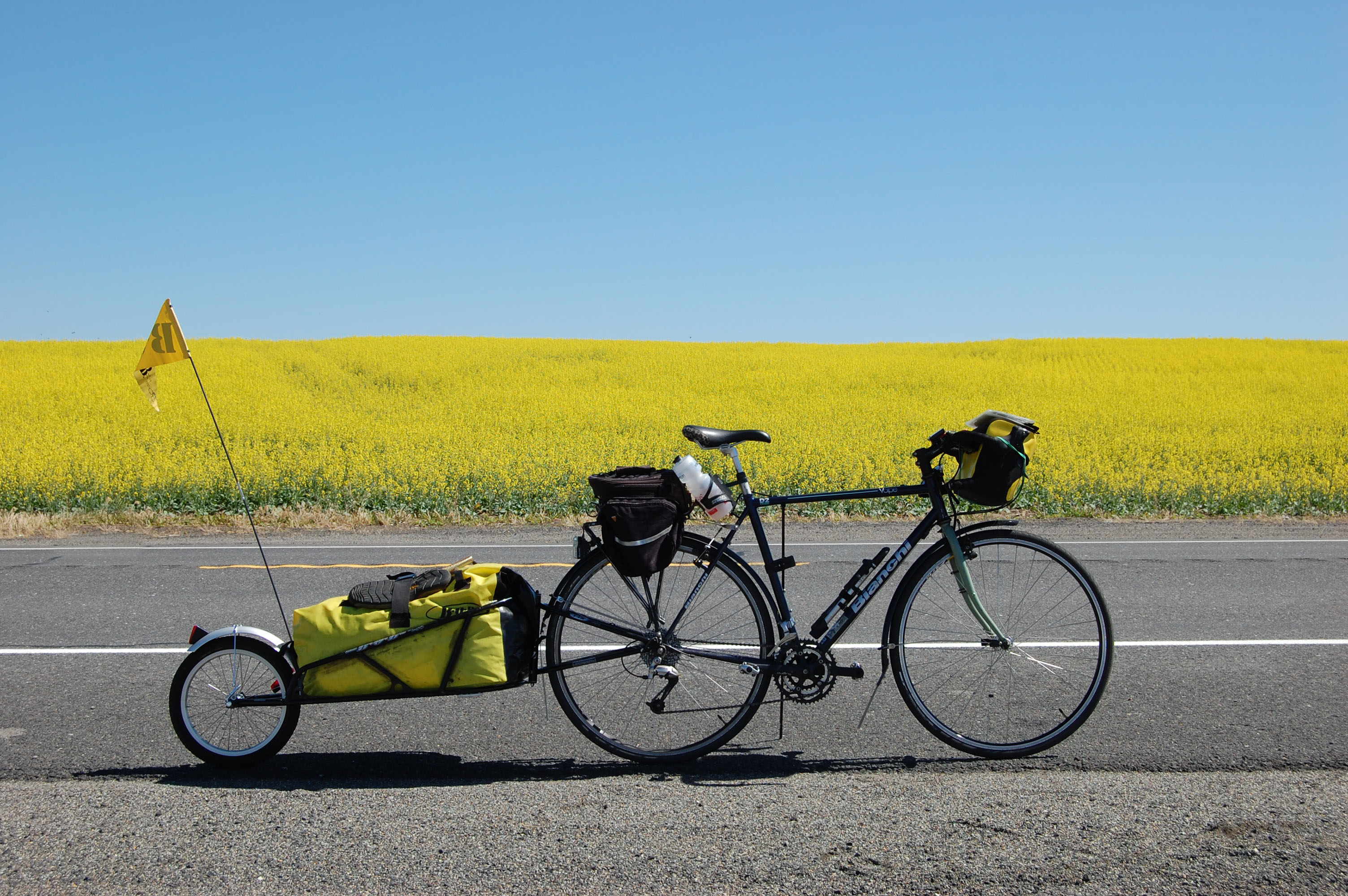
The 52-mile Everett-Lake Roesiger Loop captures a lot of what’s great about country riding: the bucolic scenery of pastures, barns, and farm animals (Snohomish has a surprising number of donkeys, for the record); quiet roads with low traffic; and relatively little climbing. It is a delightful way to spend a weekend morning.

Snohomish County Bicycle Ride

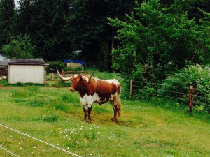
A longhorn observes he passersby.

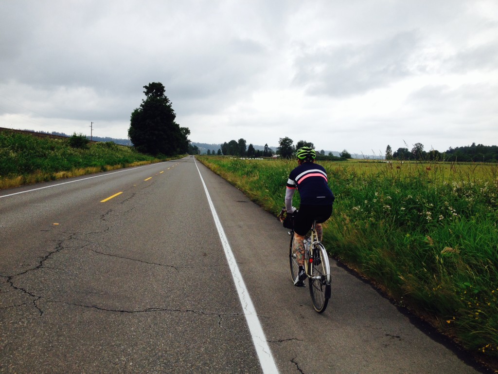
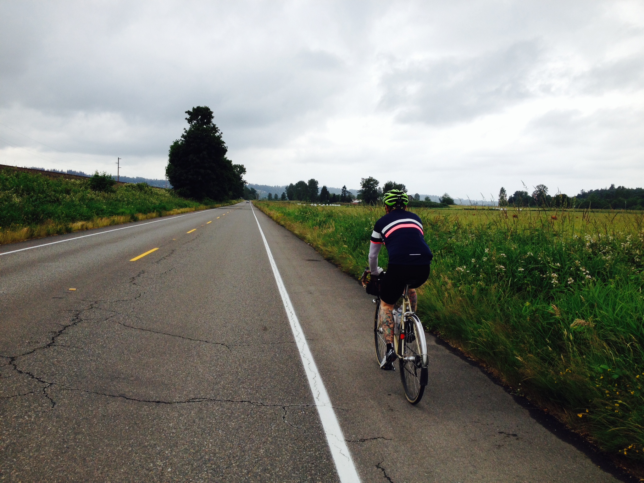
We started and ended our ride at Rotary Park on the Snohomish River. It has ample parking and cuts out the city riding for those coming from outside of Everett. Our group of four set out on Lowell Snohomish River Road under gray, Juneuary skies. These are popular stomping grounds for local cyclists. We saw at least eight other riders in the five-mile stretch between Rotary Park and downtown Snohomish.

The parade of road cyclists continued as we passed several groups of riders on the long stretch of country road between Snohomish and Monroe. And for good reason. The shoulders aren’t very wide, but traffic is light on Old Snohomish–Monroe Road.

As we passed through Monroe, we took a turn onto Woods Creek Road for the first of three times on the loop. It was the only unpleasant section of the whole route. The shoulder is fairly narrow and traffic was heavy, even on a Saturday morning.

Luckily you leave Woods Creek after just a mile and a half and return to a quiet country lane with farms on either side. In a scene fit for a cycling film, a horse trotted over to the fence, then ran alongside us for a moment, curious about these colorful creatures pedaling past.

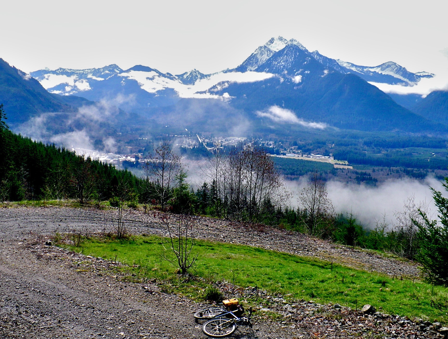
Unsurprisingly, the day’s climbing really begins on Bollenbaugh Hill Rd. But fear not, the climbing is broken into lots of short, punchy hills rather than one sustained climb and you gain just 700 vertical feet over the next 9 miles. It’s not to say you won’t feel the hills in your legs, but no herculean effort is required.Snohomish County Bicycle Ride

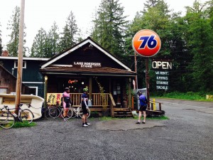
Lake Roesiger marks the halfway point of the ride. The road climbs above the water, offering nice views of the lake to the left and forest to the right. The Lake Roesiger Store sits conveniently on the north end of the lake at about mile 28. The sign outside encourages passers-by to “stop and support your local business.” We obliged and took a break to refill water bottles, have a snack, and pet the golden retriever lounging on the front porch.

Leaving the store, we made our final push to the high point of the ride then reaped the rewards of our climbing with some fast, swooping descents towards the tiny town of Machias. There may have been a few rolling hills in the mix, but all I can remember is the weightless joy of flying downhill.

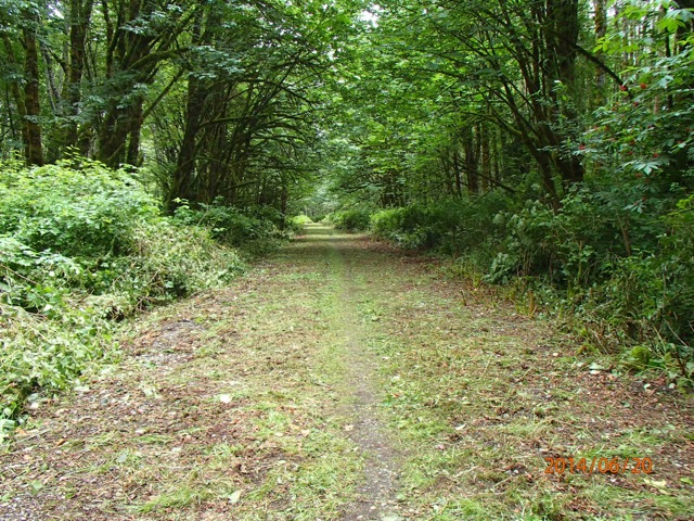
In Machias, we connected with the Centennial Trail. Flat, nicely paved, and relatively empty thanks to the threat of rain, the trail made for a relaxing couple of miles back to the town of Snohomish. As we rolled down First Avenue for the second time that day, we decided to make the almost-obligatory stop at Snohomish Bakery Creations for pastries and coffee. After all, what’s the point of a nice ride if you don’t immediately negate the calories burned with a flakey, buttery chocolate croissant?

With hot coffee and delicious pastries now weighing us down, we hopped back on our bikes for the final five miles back to Rotary Park. In true-to-the-region fashion, the sun broke through the clouds just as we pulled into the park.

Total Mileage
Cue Segment Distance (Miles)
0 East on Lowel Snohomish Rd 5.5
5.5 LEFT Airport Way 0.2
5.7 RIGHT 1st Ave 0.6
6.3 RIGHT Lincoln Ave 8.4
Becomes SnoHo-Monroe Rd
Becomes Main Street
14.7 LEFT Oaks St 0.2
14.9 RIGHT Woods Creek Rd 1.4
16.3 RIGHT Yeager Rd 1.8
18.1 RIGHT Woods Creek Rd 0.1
18.2 RIGHT Bollenbaugh Hill Rd 2.6
20.8 RIGHT Woods Creek Rd 5.1
25.9 RIGHT S. Lake Roesiger Rd 4.6
30.5 LEFT Carpenter Rd 0.5
31 SLIGHT LEFT stay on Carpenter 7.8
Becomes OK Mill Rd
38.8 LEFT Machias Rd 0.6
39.4 RIGHT Division St 0.1
39.5 LEFT Centennial Trail 5.7
45.2 RIGHT 1st Ave 0.4
45.6 LEFT Airport Way 0.1
45.7 RIGHT Lowel Snohomish Rd 5.6
51.3 END Rotary Park

Josh Cohen is a freelance writer, editor of The Bicycle Story and a contributing author to the newly released Cycling Sojourner: a Guide to the Best Multi-Day Tours in Washington.

Sign Up to Receive Updates on Biking in Snohomish County

First
Last

Posted in Adventure, Everett, Guest Blogger, News, Rural, Snohomish County, Tourism, Travel | 2 Comments

Spokane Summer Parkways Success

Last Wednesday Spokane showed its vibrance at the Summer Parkways community event held in the Manito and Comstock neighborhoods — using human transportation only. Washington Bikes was there to celebrate summer and the publication of the new Spokane Regional Bike Map by Spokane Regional Transportation Council. To pick up a new, Spokane Regional Bike Map in-person, visit the Washington Bikes’ booth at the Kidical Mass event on September 11th, 2014.

I was fortunate to have been visited by one of Spokane’s very influential bike and pedestrian safety advocates, Katie Ferris.  She serves on the Spokefest Board and has made a model-event out of Bike to School Day at Broadway Elementary School in West Valley School District. It is people like Katie Ferris who make Washington a more bike-friendly  and active place.

Kate & Katie Ferris

Katie Ferris visits the Washington Bikes booth at Spokane Summer Parkways 2014. Photo by Hank Greer.

Spokane Summer Parkways is inspired by a Colombian event called Ciclovia (meaning “bike path” in Spanish) and similar events in other parts of the world. Recreation, fitness and community combine to create a unique event which includes only human-powered transportation. All people are welcome– with or without their super-hero capes.

A young super-hero enjoys her time at Spokane Summer Parkways.

A young super-hero enjoys her time at Spokane Summer Parkways. Photo by Hank Greer.

At Wednesday’s event people of all ages and abilities enter and exit the parkway at any point along the course and can participate in a variety of the following activities:

* Bike decorating contest

* Ride a bike-powered smoothie-maker

* Hoola-hoop

* Listen to danceable music being played from stereos on bikes.

* Play their own music instruments

* See unicycles and double-decker bikes in action

* Meet local City Council members, local candidates and other public servants

* Walk, bike and play in the park

* Meet local businesses inspired by good-health

This family looks into the future with their imaginations at Summer PArkways 2014. Photo by Hank Greer.

This family looks into the future with their imaginations at Summer Parkways 2014. Photo by Hank Greer.

Spokane City Council member John Snyder helps judge the bike-decorating contest:

Spokane City Council Member is a volunteer judge for the bike-decorating contest.

Spokane City Council Member is a volunteer judge for the bike-decorating contest. Photo by Hank Greer.

Spokane County Treasurer Candidate, Amy Biviano campaigns by bike at Spokane Summer Parkways:

Amy Biviano_ County Treasurer Candidate

Join Washington Bikes at the next Spokane Summer Parkways event featuring Kidical Mass on September 11th.


Posted in News | Comments Off on Spokane Summer Parkways Success

Heads-up: Getting Your Bike Through Highway Construction in Snohomish County & Whatcom County

Give-em-a-Brake_Construction-Zone-SignsThe Washington State Department of Transportation currently has contractor crews paving four sections of SR 9 — three shorter ones in the Arlington area and one long section in Whatcom County. The work will continue through mid-August.

Much of the project has wide shoulders that will safely allow bicyclists to pass. But during the paving project, some sections of the work zone could be potentially hazardous for bicyclists or could create situations where bicycles would interact with motorized vehicles on the highway. These include

  • SR 9 Milepost 23.70 to Milepost 28.88 in the Arlington area
  • SR 9 Milepost 69.46 to Milepost 79.41 in Whatcom County

To safely get cyclists through these sections, the contractor has established signed bicycle staging areas at each end of the work zone. This will allow the contractor to safely ferry bicyclists through the work zone. The staging areas are located at locations with cell phone service. Either a project flagger will call for a truck to transport the bicyclists through the work zone, or there will be a phone number to call a construction supervisor, who will transport the bicyclists. Delays for bicyclists should be 20 minutes or less.

The bicycle staging areas will only operate during construction hours:

  • 8 a.m. to 3 p.m. and 7 p.m. to 5 a.m. near Arlington
  • 8 a.m. to 6 p.m. in Whatcom County

At other hours, bicyclists should proceed with caution because of loose gravel on the roadway.

For project updates, go WSDOT’s construction update pages for Snohomish and Whatcom counties:

Want to stay up on bike news around the state? Sign up for our e-news.

Your Turn

  • If you ride through this area let us know how it goes.


Posted in Alert, Arlington, Infrastructure, News, Snohomish County, Whatcom County, WSDOT | Comments Off on Heads-up: Getting Your Bike Through Highway Construction in Snohomish County & Whatcom County

An End of Year Bike Story

Jonathan’s poster that was the school winner for Dry Creek Elementary in Port Angeles, and won 3rd place in the Washington State 5th Grade Poster Contest.

The most amazing thing happened at the end of the year during Dry Creek Elementary’s Aloha Assembly in Port Angeles, WA.

The assembly included celebration of many end-of-year awards for their students.

One award was for Jonathan Daracunas, who won 3rd place in Washington’s 5th Grade Bicycle Poster Contest sponsored by Saris. Jonathan joyfully went up on stage to accept his prizes, a bike helmet and reflective strap. As he said thank you, he added, “All I need now is a bike!”

Another award presented a few minutes later was a bike donated from the local DeMolay Club. Students could enter to win the bike once they reached their individual reading goal. Jonathan had been working up until the limit of that morning at 8am to meet his reading goal so he could enter. He was hoping that bike would come to him.

And the lucky bike winner was: Anna! Jonathan probably sank a little as his hopes of using his newly won helmet evaporated. The 4th grade student came forward to accept her bike. She said thank you very much but she already had a bike. Right there on the spot she said she wanted to give this bike to Jonathan. She knew he had just won the helmet, reflector and lights from the poster contest and all he needed now was a bike!

Dry Creek bike giveaway

Jonathan, Anna, their teachers, and principal with the new bike!

In the words of Jonathan’s teacher, “It was a true Aloha moment that brought tears to many eyes! Kids can be so thoughtful!”


Posted in Education, Encouragement, Kids, News, Olympic Peninsula, Port Angeles, Safe Routes to School | Comments Off on An End of Year Bike Story

Ride to Gigantic Bicycle Festival and Benefit WA Bikes

2014_gigantic_bicycle_festival_posterLooking for something bikey and musical to do the weekend of August 23 & 24? You better reserve it for Gigantic Bicycle Festival and the WA Bikes team.

Gigantic Bicycle is a Pacific Northwest summer celebration of bicycle culture. The festival combines live music, visual and performance art, film, hand-built bicycles, speakers, and more into a two-day event in Snoqualmie.

Nearly one-third of the Gigantic Bicycle Festival attendees will arrive by bike on Saturday, August 23 as part of a supported ride from Magnuson Park in Seattle to the festival grounds in Snoqualmie. We hope you’ll be one of them when you register as a team rider for Washington Bikes.

Register as a team rider for Washington Bikes and Gigantic will donate 15% of your registration fee to Washington Bikes at no extra cost to you. Select Washington Bikes as your team and use the password “washingtonbikes.”

Rider registration includes a weekend festival pass, a Gigantic Bicycle Festival jersey, and Bike Reels screenings and Inky Spokes gallery events throughout the year. You have two fairly challenging routes to choose from: a century ride and a 77-mile option.

Overnight camping is available as an add-on option for the ride so you can make a weekend of it. Go to the Gigantic Bicycle Festival website to learn more about the event and their weekend line-up.

Posted in Bike Culture, Events, King County, Rides, Seattle, Snoqualmie | 2 Comments

Snohomish County Bikes: Seattle to Edmonds — Day Trip to the Salish Sea

Snohomish County Bikes: an ongoing series highlighting great bike rides across Snohomish County.

The smell of salt water, a place to sit outside and look out at the horizon, a pleasant little downtown to wander around: We headed to Edmonds for all this and a cup of coffee and enjoyed a great day trip from Seattle into Snohomish County. (Learn more about the Salish Sea thanks to Stefan Freelan of Western Washington University.)

How Long Is a Day Trip?

The length of the ideal day trip by bike varies depending on who you ask and how much you ride. If you bike regularly for short errands and outings of 2-3 miles, a 10-mile trip isn’t that big a leap. Going for a 40-mile day, however, you’re going to feel it. For a daily commuter doing more like 10-15 miles a day 40 will be less of a jump.

The key to the comfortable day trip lies not just in the length, but in how you break it up. Find some pleasant destinations the right distance apart and you’ll be able to ride more than you thought you could.

For this destination, you can opt for more direct routes or ones with longer mileage, and you can use transit to cut the mileage down. The point is to enjoy the ride — not to do so much mileage you end up exhausted and unhappy.

For you high-mileage types who will find this trip “too short,” you may just find (as my training/racing husband did) that a sunny Sunday at a much different average speed makes a nice change of pace on a recovery day.

Designing the Route

All maps start from the Washington Bikes store/office in Pioneer Square. Click on “More Options” in each map to open it in a separate window and adjust for your starting point and other preferences.

WA Bikes sits close to transit connections, including Amtrak coming into King Street Station, light rail from the airport, and the ferry terminal, so we make a great first stop for bike travelers to pick up bike maps (and a copy of our bike tour book makes a good companion, too!). If you need a tune-up, Back Alley Bike Repair in Nord Alley right behind our office will set you up.

You’ll make the trip longer by using the Burke-Gilman Trail, which you could do coming or going. Here’s the funny thing about the BGT: Once you’re on it, you’re separated from a lot of good food, coffee, breweries…. So choose your route based on when you think you’ll need those fueling stops.

Look at the terrain profile before deciding. While you won’t ride anywhere in this region without some climbing you can choose a route that gives you quite a few downhills in one direction, so of course it would have you climbing endlessly going the other direction, possibly without the shoulder space you need.

Another option not addressed here: Use the Sounder commuter train to get either to or from Edmonds, depending on how you choose to organize the trip. It only runs on weekdays at times serving peak commuter traffic so you’ll need to plan carefully to work it in.

Option 1: Bike to Edmonds from downtown Seattle, ~18 miles

This first map routes you through neighborhoods with possible refreshment stops and makes use of trails and bike lanes wherever possible.

Total pedal time: Roughly 2 hours to Edmonds, not counting coffee stops.

Food in Fremont: 

Tricky spot in Ballard: Pay lots of attention to the street configuration as you reach Fred Meyer in Ballard. In a temporary fix to a gap in the BGT, you’ll use a two-way bike lane in a street corridor shared with a one-way car lane. It’s a bit odd and your best bet may be to convert to pedestrian mode to sort out the access to the lane.

Coffee in Greenwood: Farther north, if you passed on a Fremont stop and are regretting it, stop at Herkeimer’s Coffee in Greenwood. But don’t linger too long in any of these pleasant neighborhoods; your goal is Edmonds.
[Tweet “The best bike day trips tell you where to stop for coffee, like this Seattle/Edmonds plan. #SEAbikes #bikesnoco”]

 Option 2: Bus to Lake City, bike ~10 miles to Edmonds

Depending on time of day and day of week, Sound Transit #522 or King County Metro #312 will drop you at Lake City Way and 125th. This cuts bike time to Edmonds in half and puts you within a block of Kaffee Klatsch, where you can park your bike in the big rack that takes up a parking space out front and fuel up with German baked goodies before heading west and north.

Food in Lake City: Better yet, plan this for your return and hit one of the restaurants in a mini-international district along the blocks near the transit stop:

Total pedal time: Approximately 1 hour to Edmonds from the transit stop at 125th NE. Transit time varies depending on your starting point and transfers. From downtown, Sound Transit #522 is an express; it’s about 20-25 minutes or so from the 4th/Jackson stop near WA Bikes to 125th NE/Lake City Way.

On this route you’ll ride through mostly quiet residential streets, a couple of busier streets, and then pick up the Interurban Trail for a short stretch.

When you get onto N. Richmond Beach Road it’s a busy 4-lane street but you’ll end up with a fast downhill under tall trees. This isn’t the first route Google Maps will suggest; we modified it to try to get closer to glimpses of water en route.

Watch for the Richmond Beach Coffee Shop on your right. You might opt to turn off to explore Richmond Beach Saltwater Park, with its off-leash dog park and pebbly beach, before continuing to Edmonds.

Woodway Park Road is an especially pretty part of this route: Shady, with big, beautiful homes along the way. It has a narrow shoulder but you’re downhill going north.

As you arrive in Edmonds prepare for ferry traffic. This route brings you straight to the turn for the dock, so depending on the time of your arrival you may get stuck waiting for the left turn. You can always opt to become a pedestrian and walk your bike to execute the left from 3rd onto Main toward the ferry landing, waterfront park area, and Waterfront Coffee House.

What to Do in Edmonds

Well, for one thing, there’s the waterfront staring you right in the face. On each side of the ferry you’ll find park space on the water with benches for your unwinding time.

The park to the north of the landing has bathrooms and drinking fountain, along with signage about the underwater diving park that explains the many buoys near shore. The shore wind makes this a fun place for kite-flying, too.
[Tweet “I’m putting this Seattle/Edmonds day trip on my #bikeit list. It’s about the ice cream. #SEAbikes #bikesnoco”]

Mini-ice-cream-cones_Waterfront-Coffee_EdmondsWe stopped in at Waterfront Coffee Company, which no doubt goes absolutely nuts when people waiting for the ferry need a quick caffeine fix. We got there late enough in the day that the pastry assortment was down but they had plenty of Snoqualmie Ice Cream in the case, and the cutest miniature ice cream cones you’ve ever seen in case you need just a tiny taste of that full-fat goodness.

If we’d been there on a Saturday we definitely would have checked out the Snohomish Farmers’ Market (May 4-Oct. 21 in 2014). Fresh berries, baked goodies, and all the flavors of the season.

We focused our day on doing things that didn’t cost money: Ride our bikes, look at the water, enjoy public art. Thus we didn’t check out the shopping, but it’s there along with places to eat identified in this map of Edmonds restaurants (PDF), a historical museum, and Thursday night Art Walks.

This slideshow requires JavaScript.

Return from Edmonds to Lake City: 8.8 miles

Don’t backtrack the way you came. You’ll climb up with no shoulder on roads that yielded a lot of fun coming down.

Instead, this map makes use of the Interurban North for a stretch and takes you to the Burke-Gilman Trail via Honey Bear Bakery in Lake Forest Park and 192 Brewing Company right on the trail in Shoreline— strategically placed refreshment stops.

From either of these you can take the trail south, then leave it and head to the transit stop in Lake City to call it a day.

If you’re doing this, I advise leaving the trail at 42nd Pl. NE for a slightly shallower climb full of switchbacks rather than the much steeper,  in-your-face climb at 123rd. You’ll come to the top at 42nd Ave. NE; take that south to 123rd, then turn right to reach Lake City Way in the stretch with the restaurants listed above.

Return from Edmonds to Pioneer Square, Seattle: 25.5 miles

This map takes you by bike all the way back to Pioneer Square, leaving the trail at a strategic point to route you past Chaco Canyon Organic Cafe in the University District (and you’ll find lots of other food choices in the area).

This also enables you to skip the well-signed but slow and challenging construction zone in the midst of the University of Washington campus, and it sets you up for the University Bridge crossing. (Google Maps will always try to route you to the Fremont Bridge — your option to do that instead and it’s a pleasant ride; this just gives you a different route and views.)

Since this is designed as a leisure ride, the map departs from heavily traveled Eastlake to utilize the Chesiahud Lake Union “Trail”– an on-street route that keeps you close to the water.

And there you have it: A day trip of varying lengths depending on your starting point and preferences, with lots of refreshment stops to give your legs a break if they need it.

If nothing else, stop in at a couple of these places, buy a small item as a thank-you for use of the restroom and chance to refill a water bottle, and tell them you represent two-wheeled business and appreciate them being bike-friendly. You’ll make them even more welcoming for the next bike visitor.

Your Turn: Write Your Ride

Write your ride and introduce someone to your favorite day ride. Whether it’s a loop or an out-and-back, you’re providing them with fresh eyes on a new place to venture on two wheels.

Try to keep the route description between 1000-1500 words. Link to websites or other interesting webpages by including the web addresses in brackets next to the word(s) they should be linked to in the post.
Quickly, what are the things that someone needs to see or experience on the ride? What's the best coffee shop, bakery, or restaurant on the route? The viewpoint you shouldn't miss?

Maximum file size: 516MB

Select a photo to send to us. If need be, let us know in the fields above about additional photos to include in your post.
In a sentence or two, tell us a little about you. Feel free to include links to your website or blog.

Posted in Adventure, Edmonds, Lake Forest Park, News, Seattle, Tourism, Travel | 1 Comment