Nothing launches me into scheming and daydreaming for an adventure like a good map. Maps reveal interesting routes to destinations near and far. They help me plan a bike tour through Canada’s Gulf Islands, plot a backpacking route into Eagle Cap Wilderness, and navigate my way to a mountain onsen in Japan.
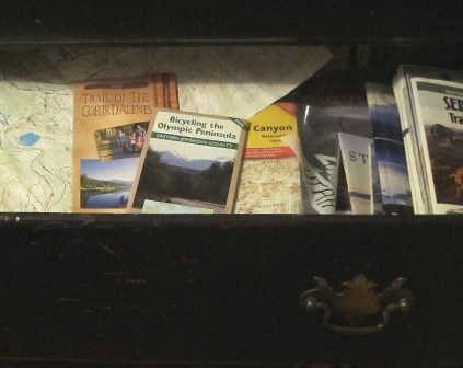
Maps are my friends and I am blessed to have an abundance of them. In fact, I confess that I have a dresser drawer full of maps. I have maps that accompany me on urban bike commutes, bike tours, mountain bike rides, snowshoe outings, day hikes, wilderness backpacking trips, ski tours on trails and into untracked terrain, and road trips.
The map is my co-pilot. It suggests route possibilities, warns me of potential obstacles, and guides me through unfamiliar territory. Maps take a licking and keep on ticking—or something like that. I have spilled beverages on maps, dropped them on muddy trails, used them as notepads, and refolded them all sorts of ways. They continue to serve their purpose in spite of the abuse.
“Thanks!” exclaims the grateful cyclist. “I didn’t know Seattle had a bike map.”
Seattle does indeed have a bike map. So does Vancouver, Spokane, and a host of other communities. There’s even a Washington State bike map. Check the maps section of our website for some links.
Maps can’t tell you everything, but they can reveal enough information to get you scheming on an adventure in your neighborhood or someplace far away. Where has a map led you?
3 Comments
You know what I like about maps? When you plan a route digitally, It gives suggestions point A to point B. With a “real” map, I get to look around. Options and places I might want to go instead or included into A and B. I get to “touch” them, i get to wonder what made that particular track or road go where it did. Ghost town? Historical logging RR or wagon road? Was this the end point for part of the mosquito fleet? That's what I like to do with a map.
The other thing I love about paper maps is that I can see more of an area, a 3×5 ft map gives me a better overview of how I want to get from A to B.
Now I still use street view on google maps to look a places that I haven't been to check things like bike lanes, traffic, a shoulder etc. But I love a good paper map.
On the other hand as I age, my eyes have more difficulty reading those tiny road labels.
I travel all the time with my bike – especially now since I got a folding bike which has made travelling with the bike (when I am not on the bike) so much easier. I will definitely have to check out the gulf islands – they sound AMAZING. I have to confess, I have started to rely more and more on technology (e.g. iphone/gps) than actual maps. However, I have regretted this when I have found myself in places with no service or a dying battery and no place to charge. Some things about technology are great and way easier than a traditional map. But paper maps also never run out of batteries